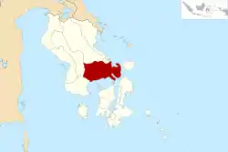
Konawe Selatan (Regierungsbezirk)
Konawe Selatan (Deutsch: Südkonawe) ist ein Regierungsbezirk (Kabupaten) auf der indonesischen Insel Sulawesi. Der Bezirk ist Teil der Provinz Sulawesi Tenggara (Südostsulawesi). Hier leben 264.197 Einwohner (2010).[1]
| Kabupaten Konawe Selatan Regierungsbezirk Südkonawe | ||
|---|---|---|
 | ||
| Symbole | ||
| ||
| Basisdaten | ||
| Staat | Indonesien | |
| Provinz | Sulawesi Tenggara | |
| Sitz | Andoolo | |
| Fläche | 4.514,2 km² | |
| Einwohner | 264.197 (2010) | |
| Dichte | 59 Einwohner pro km² | |
| ISO 3166-2 | ID-SG | |
| Webauftritt | konselkab.go.id (Indonesisch) | |
| Politik | ||
| Bupati | Drs. H. Imran, M.Si | |
Geographie
Konawe Selatan hat eine Fläche von 4.514,21 km². Hauptstadt ist Andoolo. Zum Bezirk gehörte bis 2013 auch die Insel Wawonii.
Verwaltungsgliederung
2013 wurde die Insel Wawonii als neuer Bezirk Konawe Kepulauan ausgegliedert. Der Bezirk Konawe Selatan setzt sich aus 22 administrativen Distrikten (Kecamatan) und 296 Kelurahan zusammen (Stand 2010):[2]
| Distrikt | Bevölkerung Zensus 2010 |
|---|---|
| Tinanggea | 21.320 |
| Lalembuu | 15.603 |
| Andoolo | 16.316 |
| Buke | 13.236 |
| Palangga | 12.287 |
| Palangga Selatan (Süd Palangga) | 6.139 |
| Baito | 7.562 |
| Lainea | 8.870 |
| Laeya | 19.005 |
| Kolono | 13.602 |
| Laonti | 9.444 |
| Moramo | 12,976 |
| Moramo Utara (Nord Moramo) | 7.174 |
| Konda | 18.131 |
| Wolasi | 4.730 |
| Ranomeeto | 16.223 |
| Ranomeeto Barat (West Ranomeeto) | 6.517 |
| Landono | 11.470 |
| Mowila | 11.188 |
| Angata | 14.905 |
| Benua | 9.734 |
| Basala | 8.155 |
Einzelnachweise
- Biro Pusat Statistik, Jakarta, 2011.
- Biro Pusat Statistik, Jakarta, 2011.
This article is issued from Wikipedia. The text is licensed under Creative Commons - Attribution - Sharealike. The authors of the article are listed here. Additional terms may apply for the media files, click on images to show image meta data.
