Konawe (Regierungsbezirk)
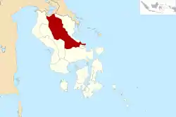
Konawe ist ein Regierungsbezirk (Kabupaten) auf der indonesischen Insel Sulawesi. Der Bezirk ist Teil der Provinz Sulawesi Tenggara (Südostsulawesi). Hier leben 241.428 Einwohner (2010).[1]
| Kabupaten Konawe Regierungsbezirk Konawe | ||
|---|---|---|
 | ||
| Symbole | ||
| ||
| Basisdaten | ||
| Staat | Indonesien | |
| Provinz | Sulawesi Tenggara | |
| Sitz | Unaaha | |
| Fläche | 16.480 km² | |
| Einwohner | 241.428 (2010) | |
| Dichte | 15 Einwohner pro km² | |
| ISO 3166-2 | ID-SG | |
| Politik | ||
| Bupati | Drs. H. Lukman Abunawas. SH, M.Si | |

Geographie
Konawe hat eine Fläche von 16.480 km². Hauptstadt ist Unaaha.
Verwaltungsgliederung
Der Bezirk Konawe setzt sich aus 23 administrativen Distrikten (Kecamatan) und 405 Kelurahan zusammen (Stand 2010):[2]
| Distrikt | Bevölkerung Zensus 2010 |
|---|---|
| Soropia | 7.753 |
| Lalonggasumeeto | 4.612 |
| Sampara | 11.719 |
| Bondoala | 8.199 |
| Besulutu | 6.759 |
| Kapoiala | 4.063 |
| Lambuya | 6.605 |
| Uepai | 11.819 |
| Puriala | 7.405 |
| Onembute | 5.941 |
| Pondidaha | 10.437 |
| Wonggeduku | 19.817 |
| Amonggedo | 9.282 |
| Wawotobi | 20.177 |
| Konawe | 8.035 |
| Unaaha | 22.694 |
| Anggaberi | 6.150 |
| Abuki | 14.407 |
| Latoma | 2.363 |
| Tongauna | 15.451 |
| Asinua | 2.480 |
| Routa | 1.892 |
Einzelnachweise
- Biro Pusat Statistik, Jakarta, 2011.
- Biro Pusat Statistik, Jakarta, 2011.
Verwaltungsgliederung der Provinz Sulawesi Tenggara
Regierungsbezirk: Bombana | Buton | Buton Selatan | Buton Tengah | Buton Utara | Kolaka | Kolaka Timur | Kolaka Utara | Konawe | Konawe Kepulauan | Konawe Selatan | Konawe Utara | Muna | Muna Barat | Wakatobi |
This article is issued from Wikipedia. The text is licensed under Creative Commons - Attribution - Sharealike. The authors of the article are listed here. Additional terms may apply for the media files, click on images to show image meta data.