Hruboňovo
Hruboňovo ist eine Gemeinde in der Slowakei.
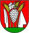
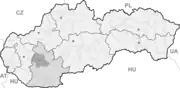
| Hruboňovo | |||
|---|---|---|---|
| Wappen | Karte | ||
 |
| ||
| Basisdaten | |||
| Staat: | Slowakei | ||
| Kraj: | Nitriansky kraj | ||
| Okres: | Nitra | ||
| Region: | Nitra | ||
| Fläche: | 11,55 km² | ||
| Einwohner: | 536 (31. Dez. 2020) | ||
| Bevölkerungsdichte: | 46 Einwohner je km² | ||
| Höhe: | 190 m n.m. | ||
| Postleitzahl: | 951 25 | ||
| Telefonvorwahl: | 0 37 | ||
| Geographische Lage: | 48° 27′ N, 18° 2′ O | ||
| Kfz-Kennzeichen: | NR | ||
| Kód obce: | 500313 | ||
| Struktur | |||
| Gemeindeart: | Gemeinde | ||
| Gliederung Gemeindegebiet: | 2 Gemeindeteile | ||
| Verwaltung (Stand: November 2018) | |||
| Bürgermeister: | Vladimír Fabo | ||
| Adresse: | Obecný úrad Hruboňovo 153 95125 Hruboňovo | ||
| Statistikinformation auf statistics.sk | |||
Sie entstand 1960 durch den Zusammenschluss der Gemeinden Šuľany (deutsch Sulan, ungarisch Szulány) und Výčapky (deutsch Klein-Vicsap, ungarisch Kisvicsáp) und ist nach Ľudovít Hruboň, einem Kämpfer im Slowakischen Nationalaufstand benannt worden.
Weblinks
Commons: Hruboňovo – Sammlung von Bildern, Videos und Audiodateien
This article is issued from Wikipedia. The text is licensed under Creative Commons - Attribution - Sharealike. The authors of the article are listed here. Additional terms may apply for the media files, click on images to show image meta data.