East Fork (Arizona)
East Fork (Westliche Apachen: Hawú'ishįįhé) ist ein Census-designated place im Navajo County im US-Bundesstaat Arizona. East Fork hat 880 Einwohner auf einer Fläche von 7,5 km². East Fork liegt auf 1597 m. ü. M. in der Fort-Apache-Reservation im Süden des Countys.
| East Fork | |
|---|---|
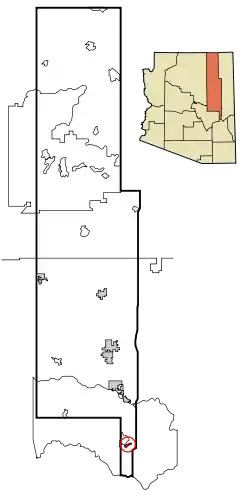 Lage im County und in Arizona | |
| Basisdaten | |
| Staat: | Vereinigte Staaten |
| Bundesstaat: | Arizona |
| County: | Navajo County |
| Koordinaten: | 33° 48′ N, 109° 56′ W |
| Zeitzone: | Mountain Standard Time (UTC−7) |
| Einwohner: | 672 (Stand: 2020) |
| Fläche: | 7,5 km² (ca. 3 mi²) davon 7,5 km² (ca. 3 mi²) Land |
| Höhe: | 1597 m |
| FIPS: | 04-21310 |
| GNIS-ID: | 0025319 |
Bildung
East Fork liegt im Whiteriver Unified School District.
Verkehr
Westlich von East Fork verläuft die Arizona State Route 73.
This article is issued from Wikipedia. The text is licensed under Creative Commons - Attribution - Sharealike. The authors of the article are listed here. Additional terms may apply for the media files, click on images to show image meta data.