Campo Lameiro
Campo Lameiro ist eine galicische Gemeinde in der Provinz Pontevedra im Nordwesten Spaniens mit 1817 Einwohnern (Stand 2019).
| Campo Lameiro | |||
|---|---|---|---|
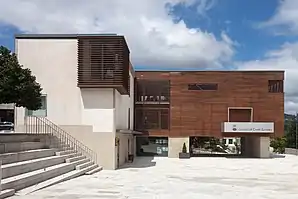 Rathaus | |||
| Wappen | Karte von Spanien | ||
 |
| ||
| Basisdaten | |||
| Autonome Gemeinschaft: | |||
| Provinz: | Pontevedra | ||
| Koordinaten | 42° 33′ N, 8° 33′ W | ||
| Fläche: | 63,77 km² | ||
| Einwohner: | 1.817 (1. Jan. 2019)[1] | ||
| Bevölkerungsdichte: | 28,49 Einw./km² | ||
| Postleitzahl: | 36110 | ||
| Gemeindenummer (INE): | 36007 | ||
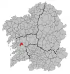
| Lage der Stadt | |||
 | |||

Gliederung
Die Gemeinde ist in die folgenden Parroquias gegliedert:
- Campo (San Miguel)
- Couso (San Cristóbal)
- Fragas (Santa Marina)
- Montes (San Isidro)
- Murillas (Santiago)
- Muimenta (Santa María)
Bevölkerungsentwicklung
| Jahr | 1842 | 1900 | 1950 | 1981 | 1991 | 2001 | 2011 |
|---|---|---|---|---|---|---|---|
| Einwohner | 3394 | 4175 | 3774 | 2847 | 2662 | 2235 | 2017 |
| Quelle: INE[2] | |||||||
Sehenswürdigkeiten
Campo Lameiro ist die galicische Hauptstadt der Felskunst, mit einer großen Sammlung von Petroglyphen, die sich im Parque Arqueolóxico da Arte Rupestre befindet.
Weblinks
Einzelnachweise
- Cifras oficiales de población resultantes de la revisión del Padrón municipal a 1 de enero. Bevölkerungsstatistiken des Instituto Nacional de Estadística (Bevölkerungsfortschreibung).
- INEbase. Alteraciones de los municipios. Abgerufen am 6. Juni 2021.
Agolada | Arbo | Baiona | Barro | Bueu | Caldas de Reis | Cambados | Campo Lameiro | Cangas | A Cañiza | Catoira | Cerdedo-Cotobade | Covelo | Crecente | Cuntis | Dozón | A Estrada | Forcarei | Fornelos de Montes | Gondomar | O Grove | A Guarda | A Illa de Arousa | Lalín | A Lama | Marín | Meaño | Meis | Moaña | Mondariz | Mondariz-Balneario | Moraña | Mos | As Neves | Nigrán | Oia | Pazos de Borbén | Poio | Ponte Caldelas | Ponteareas | Pontecesures | Pontevedra | O Porriño | Portas | Redondela | Ribadumia | Rodeiro | O Rosal | Salceda de Caselas | Salvaterra de Miño | Sanxenxo | Silleda | Soutomaior | Tomiño | Tui | Valga | Vigo | Vila de Cruces | Vilaboa | Vilagarcía de Arousa | Vilanova de Arousa