Belá nad Cirochou
Belá nad Cirochou (bis 1927 slowakisch „Cirocká Belá“; ungarisch Cirókabéla) ist eine Gemeinde in der Ostslowakei.
| Belá nad Cirochou | |||
|---|---|---|---|
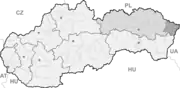
| Wappen | Karte | ||
 |
| ||
| Basisdaten | |||
| Staat: | Slowakei | ||
| Kraj: | Prešovský kraj | ||
| Okres: | Snina | ||
| Region: | Horný Zemplín | ||
| Fläche: | 17,348 km² | ||
| Einwohner: | 3.402 (31. Dez. 2020) | ||
| Bevölkerungsdichte: | 196 Einwohner je km² | ||
| Höhe: | 211 m n.m. | ||
| Postleitzahl: | 067 81 | ||
| Telefonvorwahl: | 0 57 | ||
| Geographische Lage: | 48° 58′ N, 22° 6′ O | ||
| Kfz-Kennzeichen: | SV | ||
| Kód obce: | 520039 | ||
| Struktur | |||
| Gemeindeart: | Gemeinde | ||
| Verwaltung (Stand: November 2018) | |||
| Bürgermeister: | Ján Vajda | ||
| Adresse: | Obecný úrad Belá nad Cirochou Osloboditeľov 23 06781 Belá nad Cirochou | ||
| Webpräsenz: | www.belanadcirochou.sk | ||
| Statistikinformation auf statistics.sk | |||
Lage
Sie liegt im Cirocha-Tal, am Fuße des Vihorlat-Gebirges, an der Hauptstraße I/74, 4 km westlich von Snina und 18 km östlich von Humenné entfernt. Die Hauptstraße I/74, die beide Städte miteinander verbindet, führt weiter zur ukrainischen Grenze.
Geschichte
Der Ort wurde 1451 erstmals erwähnt. Im Ort gibt es eine römisch-katholische Kirche aus dem Jahr 1912.
Weblinks
Commons: Belá nad Cirochou – Sammlung von Bildern, Videos und Audiodateien
This article is issued from Wikipedia. The text is licensed under Creative Commons - Attribution - Sharealike. The authors of the article are listed here. Additional terms may apply for the media files, click on images to show image meta data.