Klenová (Slowakei)
Klenová (ungarisch Kelen – bis 1902 und 1939–1945 Klenova) ist eine Gemeinde in der Ostslowakei.
| Klenová | |||
|---|---|---|---|
| Wappen | Karte | ||
 |
| ||
| Basisdaten | |||
| Staat: | Slowakei | ||
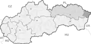
| Kraj: | Prešovský kraj | ||
| Okres: | Snina | ||
| Region: | Horný Zemplín | ||
| Fläche: | 20,03 km² | ||
| Einwohner: | 503 (31. Dez. 2020) | ||
| Bevölkerungsdichte: | 25 Einwohner je km² | ||
| Höhe: | 255 m n.m. | ||
| Postleitzahl: | 067 72 | ||
| Telefonvorwahl: | 0 57 | ||
| Geographische Lage: | 48° 56′ N, 22° 20′ O | ||
| Kfz-Kennzeichen: | SV | ||
| Kód obce: | 520365 | ||
| Struktur | |||
| Gemeindeart: | Gemeinde | ||
| Verwaltung (Stand: November 2018) | |||
| Bürgermeister: | Slavomil Voloch | ||
| Adresse: | Obecný úrad Klenová Klenová 126 06772 | ||
| Webpräsenz: | www.obecklenova.sk | ||
| Statistikinformation auf statistics.sk | |||
Der Ort wurde 1548 zum ersten Mal schriftlich als Klenau erwähnt und liegt im Mittellauf des Flusstales der Ublianka.
Von 1939 bis 1945 war der Ort von Ungarn annektiert.
Kultur
Weblinks
Commons: Klenová – Sammlung von Bildern, Videos und Audiodateien
This article is issued from Wikipedia. The text is licensed under Creative Commons - Attribution - Sharealike. The authors of the article are listed here. Additional terms may apply for the media files, click on images to show image meta data.