École (Fluss)
Die École ist ein Fluss in Frankreich, der in der Region Île-de-France verläuft. Sie entspringt im Regionalen Naturpark Gâtinais français, im Gemeindegebiet von Le Vaudoué, entwässert anfangs Richtung Nordwest, dreht dann auf Nordost und Nord und mündet nach rund 27[3] Kilometern bei Saint-Fargeau-Ponthierry als linker Nebenfluss in die Seine. Auf ihrem Weg durchquert die École die Départements Essonne und Seine-et-Marne.
| École | ||
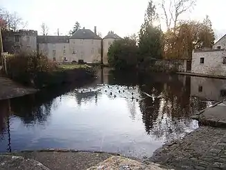
 Der Fluss vor dem Schloss in Milly-la-Forêt Der Fluss vor dem Schloss in Milly-la-Forêt | ||
| Daten | ||
| Gewässerkennzahl | FR: F4480600 | |
| Lage | Frankreich, Region Île-de-France | |
| Flusssystem | Seine | |
| Abfluss über | Seine → Ärmelkanal | |
| Quelle | im Gemeindegebiet von Le Vaudoué 48° 21′ 39″ N, 2° 31′ 29″ O | |
| Quellhöhe | ca. 67 m[1] | |
| Mündung | bei Saint-Fargeau-Ponthierry in die Seine 48° 32′ 12″ N, 2° 32′ 55″ O | |
| Mündungshöhe | ca. 36 m[2] | |
| Höhenunterschied | ca. 31 m | |
| Sohlgefälle | ca. 1,1 ‰ | |
| Länge | ca. 27 km[3] | |
| Kleinstädte | Saint-Fargeau-Ponthierry | |
Orte am Fluss
Weblinks
Commons: École – Sammlung von Bildern, Videos und Audiodateien
Anmerkungen
- Quellhöhe gemäß geoportail.gouv.fr
- Mündungshöhe gemäß geoportail.gouv.fr
- Die Angaben zur Flusslänge beruhen auf den Informationen über die École bei SANDRE (französisch), abgerufen am 14. Juni 2010, gerundet auf volle Kilometer.
This article is issued from Wikipedia. The text is licensed under Creative Commons - Attribution - Sharealike. The authors of the article are listed here. Additional terms may apply for the media files, click on images to show image meta data.