Westmorland County
Westmorland County liegt im Südosten der kanadischen Provinz New Brunswick an der Grenze zur östlichen Nachbarprovinz Nova Scotia. Größte Stadt ist Moncton, der Countysitz liegt in Dorchester. Der County hat 149.623 Einwohner (Stand: 2016).
| Westmorland County | |
|---|---|
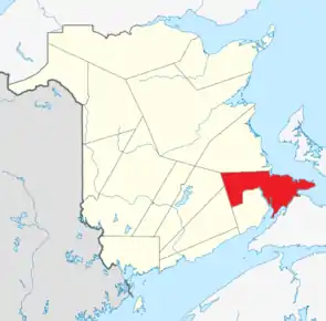 Lage der Region in New Brunswick | |
| Basisdaten | |
| Staat | Kanada |
| Provinz | New Brunswick |
| Verwaltungssitz | Dorchester |
| Koordinaten: | 45° 58′ N, 64° 31′ W |
| Einwohner | 149.623 (Stand: 2016[1]) |
| Fläche | 3.666,15 km² |
| Bevölkerungsdichte | 40,8 Einw./km² |
| Zeitzone: | Atlantic Standard Time (UTC−4) Atlantic Daylight Time (UTC−3, Sommerzeit) |
2011 betrug die Einwohnerzahl 144.158 auf einer Fläche von 3.662,02 km².[2]
Städte und Gemeinden
| Name | Status | Fläche km² | Einwohner | Ew./km² |
|---|---|---|---|---|
| Moncton | Stadt | 141,17 | 69.074 | 489,3 |
| Dieppe | Stadt | 51,17 | 23.310 | 455,5 |
| Beaubassin East | Rural community | 291,04 | 6.200 | 21,3 |
| Shediac | Kleinstadt | 11,97 | 6.053 | 505,6 |
| Sackville | Kleinstadt | 74,32 | 5.558 | 74,8 |
| Memramcook | Dorf | 185,71 | 4.831 | 26,0 |
| Cap-Pelé | Dorf | 23,78 | 2.256 | 94,9 |
| Salisbury | Dorf | 13,68 | 2.208 | 161,4 |
| Petitcodiac | Dorf | 17,22 | 1.429 | 83,0 |
| Dorchester | Dorf | 5,74 | 1.167 | 203,3 |
| Port Elgin | Dorf | 2,61 | 418 | 160,1 |
Weblinks
Commons: Westmorland County – Sammlung von Bildern, Videos und Audiodateien
Einzelnachweise
- Statistics Canada: Census Profile, 2016 Census – Westmorland, County (Census division), New Brunswick and New Brunswick (Province), abgerufen am 14. Juni 2021
- Census Profile: Westmorland. Statistics Canada, abgerufen am 8. August 2012 (englisch).
This article is issued from Wikipedia. The text is licensed under Creative Commons - Attribution - Sharealike. The authors of the article are listed here. Additional terms may apply for the media files, click on images to show image meta data.