Szentliszló
Szentliszló ist eine ungarische Gemeinde im Kreis Letenye im Komitat Zala.
| Szentliszló | |||||
| |||||
| Basisdaten | |||||
|---|---|---|---|---|---|
| Staat: | Ungarn | ||||
| Region: | Westtransdanubien | ||||
| Komitat: | Zala | ||||
| Kleingebiet bis 31.12.2012: | Letenye | ||||
| Kreis seit 1.1.2013: | Letenye | ||||
| Koordinaten: | 46° 35′ N, 16° 50′ O | ||||
| Fläche: | 6,89 km² | ||||
| Einwohner: | 299 (1. Jan. 2011) | ||||
| Bevölkerungsdichte: | 43 Einwohner je km² | ||||
| Telefonvorwahl: | (+36) 93 | ||||
| Postleitzahl: | 8893 | ||||
| KSH-kód: | 08615 | ||||
| Struktur und Verwaltung (Stand: 2018) | |||||
| Gemeindeart: | Gemeinde | ||||
| Bürgermeisterin: | Éva Domonkosné Árkus (parteilos) | ||||
| Postanschrift: | Fő utca 9 8893 Szentliszló | ||||
| Website: | |||||
| (Quelle: A Magyar Köztársaság helységnévkönyve 2011. január 1. bei Központi statisztikai hivatal) | |||||
Geografische Lage
Szentliszló liegt gut 18 Kilometer nordöstlich der Stadt Letenye. Nachbargemeinden sind Bucsuta, Pusztamagyaród und Bánokszentgyörgy.

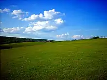
Hügellandschaft bei Szentliszló
Geschichte
Bereits im 14. Jahrhundert gab es dort eine Siedlung, die 1336 unter dem Namen Scenthwynchlou schriftlich erwähnt wurde. Ab 1723 trug der Ort seinen heutigen Namen in der Form Szent Liszló.
Sehenswürdigkeiten
- Römisch-katholische Kirche Szent Szaniszló vértanú püspök
- Szent-Szaniszló-Holzstatue (Szent Szaniszló faszobra)
- Weltkriegsdenkmal (Világháborús emlékmű)
Verkehr
In Szentliszló treffen die Landstraßen Nr. 7534 und Nr. 7536 aufeinander. Die nächstgelegenen Bahnhöfe befinden sich in östlicher Richtung in Gelse und Újudvar.
Literatur
- Szentliszló – Településképi Arculati Kézikönyve. Hrsg. von der Gemeindeverwaltung, Szentliszló 2017.
Weblinks
- Offizielle Webseite (ungarisch)
- Szentliszló község címere (ungarisch)
This article is issued from Wikipedia. The text is licensed under Creative Commons - Attribution - Sharealike. The authors of the article are listed here. Additional terms may apply for the media files, click on images to show image meta data.

