Saskatchewan Census Division No. 2
Die Census Division No. 2 in der kanadischen Provinz Saskatchewan hat eine Fläche von 16.859,2 km², es leben dort 22.825 Einwohner. 2011 betrug die Einwohnerzahl 22.266.[2] Größter Ort in der Division ist Weyburn.
| Division No. 2 | |
|---|---|
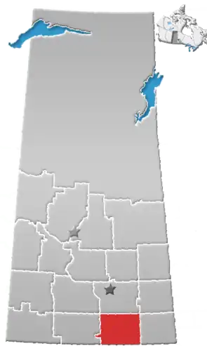 Lage der Region in Saskatchewan | |
| Basisdaten | |
| Staat | Kanada |
| Provinz | Saskatchewan |
| Koordinaten: | 49° 32′ N, 104° 15′ W |
| Einwohner | 22.825 (Stand: 2016[1]) |
| Fläche | 16.859,2 km² |
| Bevölkerungsdichte | 1,4 Einw./km² |
| Zeitzone: | Central Standard Time (UTC−6) |
Gemeinden
City
- Weyburn
Towns
- Bengough
- Midale
- Milestone
- Ogema
- Radville
- Yellow Grass
Villages
- Avonlea
- Ceylon
- Creelman
- Fillmore
- Gladmar
- Goodwater
- Halbrite
- Lake Alma
- Lang
- Macoun
- McTaggart
- Minton
- Osage
- Pangman
- Torquay
- Tribune
Hamlets
- Beaubier
- Big Beaver
- Claybank
- North Weyburn
- Parry
- Trossachs
Special Service Area
- Griffin
Rural Municipalities
- RM Cambria No. 6
- RM Souris Valley No. 7
- RM Lake Alma No. 8
- RM Surprise Valley No. 9
- RM Happy Valley No. 10
- RM Cymri No. 36
- RM Lomond No. 37
- RM Laurier No. 38
- RM The Gap No. 39
- RM Bengough No. 40
- RM Griffin No. 66
- RM Weyburn No. 67
- RM Brokenshell No. 68
- RM Norton No. 69
- RM Key West No. 70
- RM Fillmore No. 96
- RM Wellington No. 97
- RM Scott No. 98
- RM Caledonia No. 99
- RM Elmsthorpe No. 100
Indianerreservat
Piapot Cree Nation
- Piapot Cree First Nation 75H
Einzelnachweise
- Statistics Canada: Census Profile, 2016 Census – Division No. 2, Census division (Census division), Saskatchewan and Alberta (Province), abgerufen am 14. Mai 2021
- Statistics Canada: Census 2011. Abgerufen am 29. Juli 2012 (englisch).
Weblinks
- Census Profile: Census Division No. 2, Saskatchewan; Statistics Canada
- Census Profile: Karte Census Division No. 2, Saskatchewan; Statistics Canada
Division No. 1 | Division No. 2 | Division No. 3 | Division No. 4 | Division No. 5 | Division No. 6 | Division No. 7 | Division No. 8 | Division No. 9 | Division No. 10 | Division No. 11 | Division No. 12 | Division No. 13 | Division No. 14 | Division No. 15 | Division No. 16 | Division No. 17 | Division No. 18
This article is issued from Wikipedia. The text is licensed under Creative Commons - Attribution - Sharealike. The authors of the article are listed here. Additional terms may apply for the media files, click on images to show image meta data.