Saskatchewan Census Division No. 13
Die Census Division No. 13 in der kanadischen Provinz Saskatchewan hat eine Fläche von 17.255,3 km², es leben dort 23.224 Einwohner. 2011 betrug die Einwohnerzahl 23.089.[2] Größter Ort in der Division ist Kindersley.
| Division No. 13 | |
|---|---|
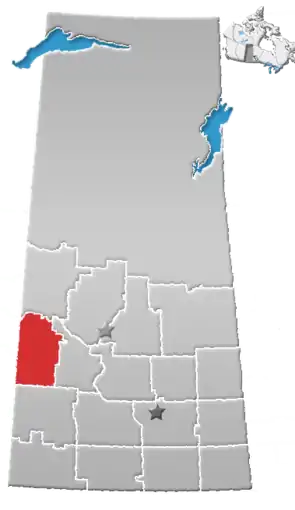 Lage der Region in Saskatchewan | |
| Basisdaten | |
| Staat | Kanada |
| Provinz | Saskatchewan |
| Koordinaten: | 52° 10′ N, 109° 13′ W |
| Einwohner | 23.224 (Stand: 2016[1]) |
| Fläche | 17.255,3 km² |
| Bevölkerungsdichte | 1,3 Einw./km² |
| Zeitzone: | Central Standard Time (UTC−6) |
Gemeinden
Towns
- Cut Knife
- Kerrobert
- Kindersley
- Luseland
- Macklin
- Scott
- Unity
- Wilkie
Villages
- Brock
- Coleville
- Denzil
- Dodsland
- Flaxcombe
- Landis
- Major
- Marengo
- Marsden
- Neilburg
- Netherhill
- Plenty
- Ruthilda
- Senlac
- Smiley
- Trumping Lake
Rural Municipalities
- RM Kindersley No. 290
- RM Milton No. 292
- RM Winslow No. 319
- RM Oakdale No. 320
- RM Prairiedale No. 321
- RM Antelope Park No. 322
- RM Grandview No. 349
- RM Mariposa No. 350
- RM Progress No. 351
- RM Heart's Hill No. 352
- RM Reford No. 379
- RM Tramping Lake No. 380
- RM Grass Lake No. 381
- RM Eye Hill No. 382
- RM Buffalo No. 409
- RM Round Valley No. 410
- RM Senlac No. 411
- RM Cut Knife No. 439
- RM Hillsdale No. 440
- RM Manitou Lake No. 442
Indianerreservate
- Little Pine 116
- Poundmaker 114
Weblinks
Einzelnachweise
- Statistics Canada: Census Profile, 2016 Census – Division No. 13, Census division (Census division), Saskatchewan and Alberta (Province), abgerufen am 14. Mai 2021
- Statistics Canada: Census 2011. Abgerufen am 29. Juli 2012 (englisch).
Division No. 1 | Division No. 2 | Division No. 3 | Division No. 4 | Division No. 5 | Division No. 6 | Division No. 7 | Division No. 8 | Division No. 9 | Division No. 10 | Division No. 11 | Division No. 12 | Division No. 13 | Division No. 14 | Division No. 15 | Division No. 16 | Division No. 17 | Division No. 18
This article is issued from Wikipedia. The text is licensed under Creative Commons - Attribution - Sharealike. The authors of the article are listed here. Additional terms may apply for the media files, click on images to show image meta data.