Saskatchewan Census Division No. 18
Die Census Division No. 18 in der kanadischen Provinz Saskatchewan ist die größte Division und hat eine Fläche von 269.996,6 km², es leben dort 37.064 Einwohner. 2011 betrug die Einwohnerzahl 36.557[2] Größter Ort in der Division ist La Ronge.
| Division No. 18 | |
|---|---|
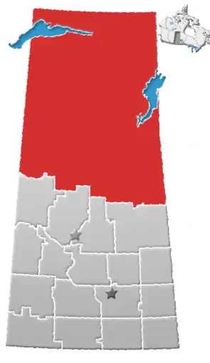 Lage der Region in Saskatchewan | |
| Basisdaten | |
| Staat | Kanada |
| Provinz | Saskatchewan |
| Koordinaten: | 57° 17′ N, 105° 52′ W |
| Einwohner | 37.064 (Stand: 2016[1]) |
| Fläche | 269.996,6 km² |
| Bevölkerungsdichte | 0,1 Einw./km² |
| Zeitzone: | Central Standard Time (UTC−6) |
Die Census Division No. 18 ist grundsätzlich deckungsgleich mit dem Northern Saskatchewan Administration District, welcher im Norden der Provinz weitgehend die Verwaltung übernimmt. Ausgenommen davon ist die Verwaltung für die 24 nördlichen Gemeinden (2 „Northern Towns“, 11 „Northern Villages“ und 11 „Northern Hamlets“).
Gemeinden
City
Villages
- Air Ronge
- Beauval
- Buffalo Narrows
- Cumberland House
- Denare Beach
- Green Lake
- Île-à-la-Crosse
- La Loche
- Pelican Narrows
- Pinehouse
- Sandy Bay
Hamlets
- Black Point
- Cole Bay
- Dore Lake
- Jans Bay
- Michel Village
- Patuanak
- St. George's Hill
- Stony Rapids
- Timber Bay
- Turnor Lake
- Weyakwin
Gemeindefreie Gebiete
- Bear Creek
- Brabant Lake
- Camsell Portage
- Descharme Lake
- Garson Lake
- Missinipe
- Sled Lake
- Southend
- Stanley Mission
- Uranium City
- Wollaston Lake
Indianerreservate
Buffalo River Dene Nation
- Peter Pond Lake 193
Black Lake Denesuline First Nation
- Chicken 224
- Chicken 225
Birch Narrows Dene Nation
- Turnor Lake 193B
Canoe Lake Tree First Nation
- Canoe Lake 165
Clearwater River Dene Nation
- Clearwater River Dene 222
- Clearwater River Dene Band 223
Cumberland House Cree Nation
- Cumberland House Cree Nation 20
English River First Nation
- La Plonge 192
- Wapachewunak 192D
Fond du Lac Dene Nation
- Fond du Lac 227
- Fond du Lac 229
- Fond du Lac 231
- Fond du Lac 232
Hatchet Lake Dene Nation
- Lac La Hache 220
Lac La Ronge Indian Band
- Four Portages 157C
- Grandmother's Bay 219
- Kitsakie 156B
- Lac La Ronge 156
- Little Hills 158
- Little Hills 158B
- Morin Lake 217
- Potato River 156A
- Stanley 157
- Sucker River 156C (Nemebian River 156C)
Montreal Lake Cree Nation
- Montreal Lake 106
Peter Ballantyne Cree Nation
- Kinoosao-Thomas Clark 204
- Pelican Narrows 184B
- Southend 200
- Sturgeon Weir 184F
Weblinks
Einzelnachweise
- Statistics Canada: Census Profile, 2016 Census – Division No. 18, Census division (Census division), Saskatchewan and Alberta (Province), abgerufen am 14. Mai 2021
- Statistics Canada: Census 2011. Abgerufen am 29. Juli 2012 (englisch).
Division No. 1 | Division No. 2 | Division No. 3 | Division No. 4 | Division No. 5 | Division No. 6 | Division No. 7 | Division No. 8 | Division No. 9 | Division No. 10 | Division No. 11 | Division No. 12 | Division No. 13 | Division No. 14 | Division No. 15 | Division No. 16 | Division No. 17 | Division No. 18