Oravská Polhora
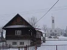
Oravská Polhora (bis 1948 slowakisch „Polhora“; ungarisch Polhora – 1882–1888 Árvapolhora, polnisch und goralisch Orawska Półgóra/Półhora) ist eine Gemeinde in der Nordslowakei. Sie ist die nördlichste Gemeinde des Landes, liegt im Gebiet der Oravské Beskydy etwa 22 km von Námestovo und 5 km vom Grenzübergang nach Polen entfernt.

Oravská Polhora
| Oravská Polhora | |||
|---|---|---|---|
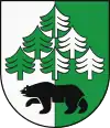
| Wappen | Karte | ||
 |
| ||
| Basisdaten | |||
| Staat: | Slowakei | ||
| Kraj: | Žilinský kraj | ||
| Okres: | Námestovo | ||
| Region: | Orava | ||
| Fläche: | 84,519 km² | ||
| Einwohner: | 4.018 (31. Dez. 2020) | ||
| Bevölkerungsdichte: | 48 Einwohner je km² | ||
| Höhe: | 688 m n.m. | ||
| Postleitzahl: | 029 47 | ||
| Telefonvorwahl: | 0 43 | ||
| Geographische Lage: | 49° 31′ N, 19° 27′ O | ||
| Kfz-Kennzeichen: | NO | ||
| Kód obce: | 509914 | ||
| Struktur | |||
| Gemeindeart: | Gemeinde | ||
| Verwaltung (Stand: November 2018) | |||
| Bürgermeister: | Michal Strnál | ||
| Adresse: | Obecný úrad Oravská Polhora 454 02947 Oravská Polhora | ||
| Webpräsenz: | www.oravskapolhora.sk | ||
| Statistikinformation auf statistics.sk | |||
Der Ort wurde 1550 zum ersten Mal schriftlich als Polgora erwähnt. Der Name Polhora soll sich von der Lage des Gemeindegebietes, das zur Hälfte vom Bergmassiv des Babia hora bestimmt wird, ableiten.
Die meisten der Einwohner sprechen einen goralischen Dialekt.
Weblinks
Commons: Oravská Polhora – Sammlung von Bildern, Videos und Audiodateien
This article is issued from Wikipedia. The text is licensed under Creative Commons - Attribution - Sharealike. The authors of the article are listed here. Additional terms may apply for the media files, click on images to show image meta data.
