Mysuru (Division)
Mysuru, ehemals Mysore, ist eine Division im indischen Bundesstaat Karnataka.
| Mysuru Division | |
|---|---|
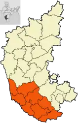 Lagekarte der Division | |
| Bundesstaat: | Karnataka |
| Koordinaten | 12° 18′ N, 76° 39′ O |
| Verwaltungssitz: | Mysuru |
| Fläche: | 43.473 km² |
| Einwohner: | 11.791.302 |
| Bevölkerungsdichte: | 271 Einwohner/km² |
| Distrikte: | 8 |
Distrikte
Die Division Mysore gliedert sich in acht Distrikte:
| Distrikt | Verwaltungssitz | Fläche in km² | Einwohner (2001) | Ew./km² |
|---|---|---|---|---|
| Chamarajanagar | Chamarajanagar | 5.101 | 965.462 | 189 |
| Chikkamagaluru | Chikkamagaluru | 7.201 | 1.140.905 | 158 |
| Dakshina Kannada | Mangaluru | 4.560 | 1.897.730 | 416 |
| Hassan | Hassan | 6.814 | 1.721.669 | 253 |
| Kodagu | Madikeri | 4.102 | 548.561 | 134 |
| Mandya | Mandya | 4.961 | 1.763.705 | 356 |
| Mysuru | Mysuru | 6.854 | 2.641.027 | 385 |
| Udupi | Udupi | 3.880 | 1.112.243 | 287 |
This article is issued from Wikipedia. The text is licensed under Creative Commons - Attribution - Sharealike. The authors of the article are listed here. Additional terms may apply for the media files, click on images to show image meta data.