Municipio San Ignacio Cerro Gordo
| San Ignacio Cerro Gordo | |
|---|---|
 | |
| Basisdaten | |
| Staat | Mexiko |
| Bundesstaat | Jalisco |
| Sitz | San Ignacio Cerro Gordo |
| Fläche | 228,1 km² |
| Einwohner | 17.626 (2010) |
| Dichte | 77,3 Einwohner pro km² |
| Gründung | 2007 |
| Webauftritt | sanignaciocg.gob.mx/ |
| INEGI-Nr. | 14125 |
| Politik | |
| Presidente municipal | Alberto Orosco Orosco |
San Ignacio Cerro Gordo ist ein Municipio im mexikanischen Bundesstaat Jalisco in der Región Altos Sur. Das Municipio hatte beim Zensus 2010 17.626 Einwohner; die Fläche des Municipios beträgt 228,1 km². Das Municipio entstand 2007 durch Abspaltung vom Municipio Arandas.
Größter Ort im Municipio und Verwaltungssitz ist das gleichnamige San Ignacio Cerro Gordo, weitere Orte mit mehr als 500 Einwohnern sind Los Dolores, La Trinidad und San Vicente. Das Municipio umfasst insgesamt 74 Ortschaften.
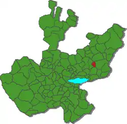
Das Municipio San Ignacio Cerro Gordo grenzt an die Municipios Tepatitlán de Morelos, San Miguel el Alto, Atotonilco el Alto und Arandas.
Das Gemeindegebiet liegt auf durchschnittlich etwa 2000 m über dem Meeresspiegel. 60 % der Fläche werden landwirtschaftlich genutzt.
Weblinks
- Enciclopedia de los Municipios y Delegaciones de México: Municipio San Ignacio Cerro Gordo (spanisch)
- INEGI: Datos Geográficos: Municipio San Ignacio Cerro Gordo (spanisch; PDF)
- jalisco.gob.mx: San Ignacio Cerro Gordo (spanisch)

Acatic | Acatlán de Juárez | Ahualulco de Mercado | Amacueca | Amatitán | Ameca | Arandas | Atemajac de Brizuela | Atengo | Atenguillo | Atotonilco el Alto | Atoyac | Autlán de Navarro | Ayotlán | Ayutla | Bolaños | Cabo Corrientes | Cañadas de Obregón | Casimiro Castillo | Chapala | Chimaltitán | Chiquilistlán | Cihuatlán | Cocula | Colotlán | Concepción de Buenos Aires | Cuautitlán de García Barragán | Cuautla | Cuquío | Degollado | Ejutla | El Arenal | El Grullo | El Limón | El Salto | Encarnación de Díaz | Etzatlán | Gómez Farías | Guachinango | Guadalajara | Hostotipaquillo | Huejúcar | Huejuquilla el Alto | Ixtlahuacán de los Membrillos | Ixtlahuacán del Río | Jalostotitlán | Jamay | Jesús María | Jilotlán de los Dolores | Jocotepec | Juanacatlán | Juchitlán | La Barca | La Huerta | La Manzanilla de la Paz | Lagos de Moreno | Magdalena | Mascota | Mazamitla | Mexticacán | Mezquitic | Mixtlán | Ocotlán | Ojuelos de Jalisco | Pihuamo | Poncitlán | Puerto Vallarta | Quitupan | San Cristóbal de la Barranca | San Diego de Alejandría | San Gabriel | San Ignacio Cerro Gordo | San Juan de los Lagos | San Juanito de Escobedo | San Julián | San Marcos | San Martín de Bolaños | San Martín Hidalgo | San Miguel el Alto | San Sebastián del Oeste | Santa María de los Ángeles | Santa María del Oro | Sayula | Tala | Talpa de Allende | Tamazula de Gordiano | Tapalpa | Tecalitlán | Techaluta de Montenegro | Tecolotlán | Tenamaxtlán | Teocaltiche | Teocuitatlán de Corona | Tepatitlán de Morelos | Tequila | Teuchitlán | Tizapán el Alto | Tlajomulco de Zúñiga | Tlaquepaque | Tolimán | Tomatlán | Tonalá | Tonaya | Tonila | Totatiche | Tototlán | Tuxcacuesco | Tuxcueca | Tuxpan | Unión de San Antonio | Unión de Tula | Valle de Guadalupe | Valle de Juárez | Villa Corona | Villa Guerrero | Villa Hidalgo | Villa Purificación | Yahualica de González Gallo | Zacoalco de Torres | Zapopan | Zapotiltic | Zapotitlán de Vadillo | Zapotlán del Rey | Zapotlán el Grande | Zapotlanejo