Morowali Utara (Regierungsbezirk)
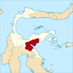
Morowali Utara (Deutsch: Nordmorowali) ist ein am 12. April 2013 eingerichteter Regierungsbezirk (Kabupaten) auf der indonesischen Insel Sulawesi. Der Bezirk ist Teil der Provinz Sulawesi Tengah (Zentralsulawesi). Hier leben 104.299 Einwohner (2010).
| Kabupaten Nordmorowali Regierungsbezirk Morowali Utara | ||
|---|---|---|
 | ||
| Symbole | ||
| ||
| Basisdaten | ||
| Staat | Indonesien | |
| Provinz | Sulawesi Tengah | |
| Sitz | Kolonodale | |
| Fläche | 18.262 km² | |
| Einwohner | 104.299 (2010) | |
| Dichte | 5,7 Einwohner pro km² | |
| ISO 3166-2 | ID-ST | |
| Politik | ||
| Bupati | Drs. Abdul Haris Rengga, MSi | |

Geographie
Morowali Utara hat eine Fläche von 18.262 km². Hauptstadt ist Kolonodale.
Verwaltungsgliederung
Der Bezirk Morowali Utara setzt sich aus neun administrativen Distrikten (Kecamatan) und 135 Kelurahan zusammen (Stand 2010):[1]
| Distrikt | Bevölkerung Zensus 2010 |
|---|---|
| Mori Atas | |
| Mori Utara (Nord Mori) | |
| Petasia | |
| Petasia Timur (Ost Petasia) | |
| Petasia | |
| Bungku Utara (Nord Bungku) | |
| Soyo Jaya | |
| Lembo | |
| Lembo Raya |
Einzelnachweise
- Biro Pusat Statistik, Jakarta, 2011.

Verwaltungsgliederung der Provinz Sulawesi Tengah
Regierungsbezirk: Banggai | Banggai Kepulauan | Banggai Laut | Buol | Donggala | Morowali | Morowali Utara | Parigi Moutong | Poso | Sigi | Tojo Una-Una | Tolitoli
Stadt: Palu
This article is issued from Wikipedia. The text is licensed under Creative Commons - Attribution - Sharealike. The authors of the article are listed here. Additional terms may apply for the media files, click on images to show image meta data.