Misool
Misool (auch Misoöl) ist mit einer Fläche von (je nach Quelle) 2034 km² bis 2041 km² eine der vier Hauptinseln des Archipels von Raja Ampat vor der Küste Westneuguineas (Indonesien).
| Misool | ||
|---|---|---|
| Gewässer | Seramsee | |
| Inselgruppe | Raja Ampat | |
| Geographische Lage | 1° 54′ S, 130° 5′ O | |
| ||
| Fläche | 2 034 km² | |
| Höchste Erhebung | Gunung Ful 565 m | |
| Hauptort | Waigama | |
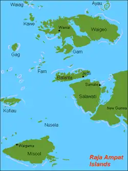 Raja-Ampat-Inseln mit Misool im Südwesten | ||
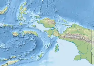
Misool liegt in der Seramsee, im Südwesten des Archipels und südwestlich der Vogelkopfhalbinsel. Nördlich liegen die Inseln Kofiau und Nusela, weiter nach Nordwesten die drei anderen Hauptinseln des Archipels: Salawati, Batanta und Waigeo. Der Archipel gehört zum Regierungsbezirk Raja Ampat der Provinz Westpapua.
Die höchste Erhebung Misools ist 565 m hoch.
This article is issued from Wikipedia. The text is licensed under Creative Commons - Attribution - Sharealike. The authors of the article are listed here. Additional terms may apply for the media files, click on images to show image meta data.