Liste der FFH-Gebiete im Landkreis Schwandorf
Die Liste der FFH-Gebiete im Landkreis Schwandorf zeigt die FFH-Gebiete des Oberpfälzer Landkreises Schwandorf in Bayern. Teilweise überschneiden sie sich mit bestehenden Natur-, Landschaftsschutz- und EU-Vogelschutzgebieten. Im Landkreis befinden sich 16 und zum Teil mit anderen Landkreisen überlappende FFH-Gebiete.
| Name | Bild | Kennung | Kreis | Einzelheiten | Position | Fläche Hektar |
Datum | ||
|---|---|---|---|---|---|---|---|---|---|
| Amphibien-Lebensräume um Etsdorf | 6538-371 WDPA: 555521598 |
Landkreis Schwandorf, Landkreis Amberg-Sulzbach | ⊙ | 34,11 | |||||
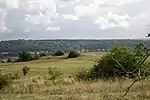
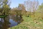
| Bayerische Schwarzach und Biberbach | 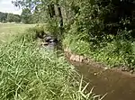 |
6541-371 WDPA: 555521601 |
Landkreis Schwandorf, Landkreis Cham | ⊙ | 530,40 | ||||
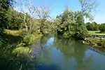
| Chamb, Regentalaue und Regen zwischen Roding und Donaumündung |
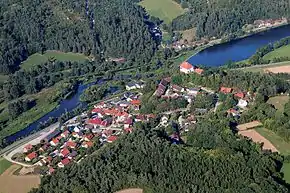 |
6741-371 WDPA: 555521700 |
Landkreis Schwandorf, Landkreis Regensburg, Landkreis Cham | auch in Regensburg | ⊙ | 3.193,53 | |||
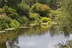
| Charlottenhofer Weihergebiet, Hirtlohweiher und Langwiedteiche |
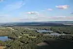 |
6639-372 WDPA: 555537819 |
Landkreis Schwandorf | ⊙ | 930,68 | ||||
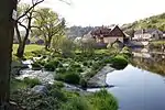
| Kulzer Moos |
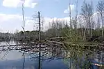 |
6640-301 WDPA: 555521653 |
Landkreis Schwandorf | ⊙ | 83,00 | ||||
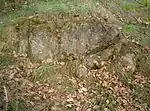
| Mausohrkolonien im Naturraum Oberpfälzisch-Bayerischer Wald |
 |
6540-302 WDPA: 555521599 |
Landkreis Schwandorf, Landkreis Regensburg, Landkreis Cham | auch in Landkreis Deggendorf, Landkreis Freyung-Grafenau | ⊙ | 0,00 | |||
| Münchshofener Berg |
 |
6738-371 WDPA: 555521696 |
Landkreis Schwandorf | ⊙ | 180,57 | ||||
| Naab unterhalb Schwarzenfeld und Donau von Poikam bis Regensburg |
 |
6937-371 WDPA: 555521761 |
Regensburg, Landkreis Regensburg, Landkreis Kelheim | auch in Landkreis Schwandorf | ⊙ | 1.114,77 | |||
| Pfreimdtal und Kainzbachtal |
 |
6439-371 WDPA: 555521551 |
Landkreis Schwandorf, Landkreis Neustadt an der Waldnaab | ⊙ | 334,43 | ||||
| Regentalhänge bei Hirschling | 6739-301 WDPA: 555521697 |
Landkreis Schwandorf, Landkreis Regensburg | ⊙ | 352,00 | |||||
| Schwarzwihrberg bei Rötz | 6640-371 WDPA: 555521654 |
Landkreis Schwandorf, Landkreis Cham | ⊙ | 209,68 | |||||
| Serpentinstandorte in der nördlichen Oberpfalz |
 |
6138-372 WDPA: 555521383 |
Landkreis Schwandorf, Landkreis Neustadt an der Waldnaab, Landkreis Tirschenreuth | ⊙ | 119,19 | ||||
| Standortübungsplatz Oberviechtach | 6540-371 WDPA: 555521600 |
Landkreis Schwandorf | ⊙ | 240,38 | |||||
| Talsystem von Schwarzach, Auerbach und Ascha |
 |
6639-371 WDPA: 555521652 |
Landkreis Schwandorf | ⊙ | 784,25 | ||||
| Vils von Vilseck bis zur Mündung in die Naab |
 |
6537-371 WDPA: 555521596 |
Landkreis Schwandorf, Landkreis Amberg-Sulzbach, Amberg | auch in Landkreis Regensburg | ⊙ | 621,95 | |||
| Waldweihergebiet im Postloher Forst | 6740-302 WDPA: 555521699 |
Landkreis Schwandorf, Landkreis Cham | ⊙ | 418,00 | |||||
| Legende für Fauna-Flora-Habitat | |||||||||
Siehe auch
Weblinks
FFH-Gebiete in den Landkreisen
Aichach-Friedberg |
Altötting |
Amberg-Sulzbach |
Ansbach |
Aschaffenburg |
Augsburg |
Bad Kissingen |
Bad Tölz-Wolfratshausen |
Bamberg |
Bayreuth |
Berchtesgadener Land |
Cham |
Coburg |
Dachau |
Deggendorf |
Dillingen an der Donau |
Dingolfing-Landau |
Donau-Ries |
Ebersberg |
Eichstätt |
Erding |
Erlangen-Höchstadt |
Forchheim |
Freising |
Freyung-Grafenau |
Fürstenfeldbruck |
Fürth |
Garmisch-Partenkirchen |
Günzburg |
Haßberge |
Hof |
Kelheim |
Kitzingen |
Kronach |
Kulmbach |
Landsberg am Lech |
Landshut |
Lichtenfels |
Lindau (Bodensee) |
Main-Spessart |
Miesbach |
Miltenberg |
Mühldorf am Inn |
München |
Neuburg-Schrobenhausen |
Neumarkt in der Oberpfalz |
Neustadt an der Aisch-Bad Windsheim |
Neustadt an der Waldnaab |
Neu-Ulm |
Nürnberger Land |
Oberallgäu |
Ostallgäu |
Passau |
Pfaffenhofen an der Ilm |
Regen |
Regensburg |
Rhön-Grabfeld |
Rosenheim |
Roth |
Rottal-Inn |
Schwandorf |
Schweinfurt |
Starnberg |
Straubing-Bogen |
Tirschenreuth |
Traunstein |
Unterallgäu |
Weilheim-Schongau |
Weißenburg-Gunzenhausen |
Wunsiedel im Fichtelgebirge |
Würzburg
FFH-Gebiete in den kreisfreien Städten
Amberg |
Ansbach |
Aschaffenburg |
Augsburg |
Bamberg |
Bayreuth |
Coburg |
Fürth |
Ingolstadt |
Kaufbeuren |
Landshut |
Memmingen |
München |
Nürnberg |
Passau |
Regensburg |
Rosenheim |
Schwabach |
Schweinfurt |
Straubing |
Würzburg