Liste der Baudenkmäler im Bonner Ortsteil Südstadt (L–Z)
Die folgende Liste enthält in der Denkmalliste ausgewiesene Baudenkmäler auf dem Gebiet des Bonner Ortsteils Südstadt im Stadtbezirk Bonn.
Hinweis: Die Reihenfolge der Denkmäler in dieser Liste orientiert sich an den Straßennamen und ist alternativ nach Hausnummern, Denkmallistennummer oder Bezeichnung sortierbar.

Basis ist die offizielle Denkmalliste der Stadt Bonn (Stand: 15. Januar 2021), die von der Unteren Denkmalbehörde geführt wird. Grundlage für die Aufnahme in die Denkmalliste ist das Denkmalschutzgesetz Nordrhein-Westfalens.
| Bild | Bezeichnung | Lage | Beschreibung | Bauzeit | Eingetragen seit |
Denkmal- nummer |
|---|---|---|---|---|---|---|
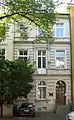 |
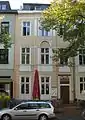
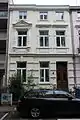
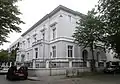
Lennéstraße 10 Karte |
1872[1] | A 2945 | |||
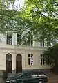 |
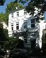
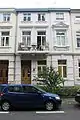
Lennéstraße 12 Karte |
1865[1] | A 2935 | |||
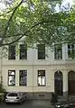 |
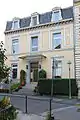
Lennéstraße 14 Karte |
A 533 | ||||
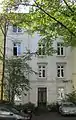 |
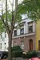
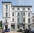
Lennéstraße 16 Karte |
1860er-Jahre[1] | A 3894 | |||
 |
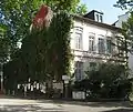
Lennéstraße 20 Karte |
1872[1] | A 2953 | |||
 weitere Bilder |
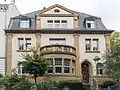
Lennéstraße 31 Karte |
1860er-Jahre[1] | A 254 | |||
 |
Lennéstraße 33 Karte |
1885[1] | A 2962 | |||
 |
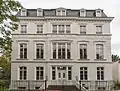
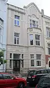
Lennéstraße 34 Karte |
Denkmalgeschützt: Fassade, Vorgarten | 1868[1] | A 4058 | ||
 weitere Bilder |
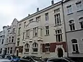
Lennéstraße 35–37 Karte |
Architekt: Otto Penner[1] | 1890/1891[1] | A 265 | ||
 |
Lennéstraße 36 Karte |
1868[1] | A 2954 | |||
| Lennéstraße 38 Karte |
1868[1] | A 266 | ||||
 |
Lennéstraße 39–41 Karte |
1869[1] | A 263 | |||
| Lennéstraße 40 Karte |
1868[1] | A 500 | ||||
| Lennéstraße 42 Karte |
vor 1870[1] | A 183 | ||||
| Lennéstraße 46 Karte |
1869[1] | A 3971 | ||||
| Lennéstraße 51 Karte |
1887[1] | A 2961 | ||||
| Lennéstraße 52 Karte |
Architekt: Max Cronenberg[1] | 1900[1] | A 2952 | |||
| Lennéstraße 53 Karte |
Architekten: Becker & Böhm[1] | 1891[1] | A 3960 | |||
| Lennéstraße 55 Karte |
1871[1] | A 3018 | ||||
| Lennéstraße 56 Karte |
1850er-Jahre[1] | A 2965 | ||||
| Lessingstraße 1 Karte |
1897[1] | A 1351 | ||||
| Lessingstraße 2 Karte |
1912[1] | A 2551 | ||||
| Lessingstraße 3 Karte |
1897[1] | A 2564 | ||||
| Lessingstraße 4 Karte |
1912[1] | A 2444 | ||||
| Lessingstraße 5 Karte |
1907[1] | A 2423 | ||||
| Lessingstraße 6 Karte |
1912[1] | A 2698 | ||||
| Lessingstraße 8 Karte |
1911[1] | A 2560 | ||||
| Lessingstraße 10 Karte |
1911[1] | A 2427 | ||||
| Lessingstraße 12 Karte |
1911[1] | A 484 | ||||
| Lessingstraße 13 Karte |
1899[1] | A 545 | ||||
| Lessingstraße 14 Karte |
Doppelhaus mit Nr. 16; Architekt: Hermann Schmitt[1] | 1896[1] | A 2451 | |||
| Lessingstraße 15 Karte |
1899[1] | A 597 | ||||
| Lessingstraße 16 Karte |
Doppelhaus mit Nr. 14; Architekt: Hermann Schmitt[1] | 1896[1] | A 1716 | |||
| Lessingstraße 17 Karte |
1896[1] | A 2625 | ||||
| Lessingstraße 18 Karte |
Doppelhaus mit Nr. 20; Architekt: Hermann Schmitt[1] | 1897[1] | A 2594 | |||
| Lessingstraße 20 Karte |
Doppelhaus mit Nr. 18; Architekt: Hermann Schmitt[1] | 1897[1] | A 429 | |||
| Lessingstraße 21 Karte |
1897[1] | A 2526 | ||||
| Lessingstraße 22 Karte |
1901/1902[1] | A 2435 | ||||
| Lessingstraße 23 Karte |
1897[1] | A 1693 | ||||
| Lessingstraße 24 Karte |
1901/1902[1] | A 538 | ||||
| Lessingstraße 25 Karte |
1897/1898[1] | A 2439 | ||||
| Lessingstraße 26 Karte |
um 1900[1] | A 2447 | ||||
| Lessingstraße 27 Karte |
1897/1898[1] | A 2438 | ||||
| Lessingstraße 29 Karte |
1897[1] | A 616 | ||||
| Lessingstraße 30 Karte |
1900[1] | A 2478 | ||||
| Lessingstraße 31 Karte |
1897[1] | A 2403 | ||||
| Lessingstraße 32 Karte |
1900[1] | A 2552 | ||||
| Lessingstraße 33 Karte |
1896[1] | A 2437 | ||||
| Lessingstraße 34 Karte |
1897[1] | A 2454 | ||||
| Lessingstraße 35 Karte |
um 1896[1] | A 2422 | ||||
| Lessingstraße 36 Karte |
1897[1] | A 2476 | ||||
| Lessingstraße 37 Karte |
um 1896[1] | A 2432 | ||||
| Lessingstraße 38 Karte |
1897[1] | A 1320 | ||||
| Lessingstraße 39 Karte |
1898[1] | A 2529 | ||||
| Lessingstraße 40 Karte |
1897[1] | A 1127 | ||||
| Lessingstraße 41 Karte |
1899[1] | A 1390 | ||||
| Lessingstraße 42 Karte |
1897[1] | A 2645 | ||||
| Lessingstraße 43 Karte |
Doppelhaus mit Nr. 45; Architekt: Max Cronenberg[1] | 1901[1] | A 473 | |||
| Lessingstraße 44 Karte |
1895[1] | A 3250 | ||||
| Lessingstraße 45 Karte |
Doppelhaus mit Nr. 43; Architekt: Max Cronenberg[1] | 1901[1] | A 2440 | |||
| Lessingstraße 46 Karte |
1895[1] | A 2434 | ||||
| Lessingstraße 47 Karte |
1903/1904[1] | A 2679 | ||||
| Lessingstraße 48 Karte |
um 1895[1] | A 2651 | ||||
| Lessingstraße 49 Karte |
1903[1] | A 537 | ||||
| Lessingstraße 50 Karte |
1898[1] | A 158 | ||||
| Lessingstraße 51 Karte |
1908/1909[1] | A 565 | ||||
| Lessingstraße 52 Karte |
1896[1] | A 262 | ||||
| Lessingstraße 54 Karte |
1896[1] | A 2483 | ||||
| Lessingstraße 56 Karte |
1895[1] | A 2446 | ||||
| Lessingstraße 57 Karte |
1900[1] | A 3227 | ||||
| Lessingstraße 58 Karte |
1899/1900[1] | A 2470 | ||||
| Lessingstraße 59 Karte |
A 2436 | |||||
| Lessingstraße 60 Karte |
Architekt: Max Cronenberg[1] | 1901[1] | A 1138 | |||
| Lessingstraße 61 Karte |
Architekt: Carl Edler[1] | 1903[1] | A 562 | |||
| Lessingstraße 63 Karte |
Architekt: Carl Edler[1] | 1901[1] | A 2396 | |||
| Lessingstraße 65 Karte |
Architekt: Carl Edler[1] | 1901[1] | A 569 | |||
 |
Loestraße 3 Karte |
1897[1] | A 3976 | |||
 |
Loestraße 6 Karte |
nach 2012 bis auf Fassade abgebrochen[2] | um 1873[2] | A 3929 | ||
 |
Loestraße 7 Karte |
1896/1897[1] | A 575 | |||
 |
Loestraße 8 Karte |
nach 2012 bis auf Fassade abgebrochen[2] | um 1873[2] | A 3930 | ||
weitere Bilder |
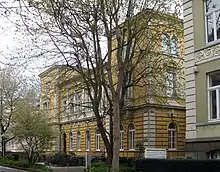
„Clara-Schumann-Gymnasium“ | Loestraße 14 Karte |
Architekt: Stadtbaumeister Rudolf Schultze[3] | 1913–1915[4][1] | A 1136 | |
 |
Loestraße 17 Karte |
1890er-Jahre[1] | A 2485 | |||
 |
Loestraße 25 Karte |
1880er-Jahre[1] | A 1226 | |||
 |
Loestraße 27 Karte |
1880er-Jahre[1] | A 1175 | |||
 |
Maarflach 2 Karte |
1874[1] | A 2907 | |||
| Nassestraße 1 Karte |
1872[1] | A 2889 | ||||
| Nassestraße 5 Karte |
1873[1] | A 3401 | ||||
| Nassestraße 7 Karte |
1873[1] | A 3399 | ||||
| Nassestraße 9 Karte |
1895[1] | A 3400 | ||||
 |
Poppelsdorfer Allee 15 Karte |
Architekt: Christian von der Emden[5] | 1854[5] | A 3171 | ||
| Poppelsdorfer Allee 17 Karte |
Architekt: Christian von der Emden[5] | 1854[5] | A 2028 | |||
 |
Poppelsdorfer Allee 25 Karte |
um 1838[6], 1879 (Aufstockung/Umbau)[7] | A 2079 | |||
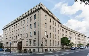 |
Poppelsdorfer Allee 31–33 Karte |
Verwaltungsgebäude des Deutschen Herolds | 1949–1950[8] | A 4144 | ||
| Poppelsdorfer Allee 43 Karte |
1870er-Jahre[1] | A 3117 | ||||
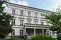
| Wohngebäude[9] | Poppelsdorfer Allee 45 Karte |
Architekt: Karl Thoma (1913/14)[9] | um 1869/1870, 1913/1914 (Um-/Ausbau, Fassade)[9] | 23. August 1991[9] | A 2085 | |
 weitere Bilder |
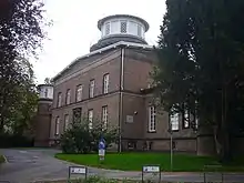
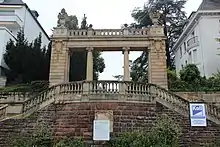
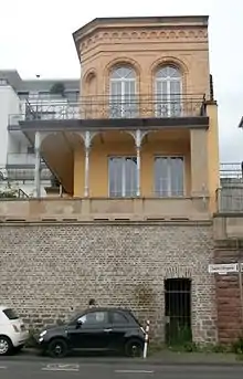
Ehemalige Sternwarte | Poppelsdorfer Allee 47 Karte |
1840–1844 | A 163 | ||
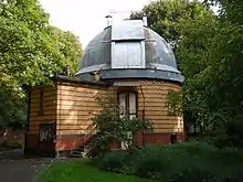 |
Refraktorium der Alten Sternwarte | Poppelsdorfer Allee 47 Karte |
1899 | A 941 | ||
 weitere Bilder |
Poppelsdorfer Allee 51 Karte |
Doppelhaus mit Argelanderstraße 1;[9] Architekt: Otto Penner[9] | 1889[1] | A 1705 | ||
| Poppelsdorfer Allee 53 Karte |
Teil der Hausgruppe Poppelsdorfer Allee 53–59 | 1908[10] | A 1101 | |||
.jpg.webp) weitere Bilder |
Wohngebäude[9] | Poppelsdorfer Allee 55 Karte |
Teil der Hausgruppe Poppelsdorfer Allee 53–59 | 1908[10] | 29. Dezember 1986[9] | A 1097 |
| Poppelsdorfer Allee 57 Karte |
Teil der Hausgruppe Poppelsdorfer Allee 53–59 | 1908[10] | A 458 | |||
| Poppelsdorfer Allee 59 Karte |
Teil der Hausgruppe Poppelsdorfer Allee 53–59 | 1908[10] | A 637 | |||
| Wohngebäude[9] | Poppelsdorfer Allee 61 Karte |
um 1860, 1895 (Aufstockung)[9][11] | 9. April 1985[9] | A 802 | ||
 weitere Bilder |
Poppelsdorfer Allee 63/ Venusbergweg Karte |
Architekt: Julius Rolffs[1] | 1910/1911[1] | A 2127 | ||
 weitere Bilder |
Poppelsdorfer Allee 65/ Venusbergweg Karte |
1860er-Jahre, nach 1875 (An-/Umbauten)[12] | A 951 | |||
| Prinz-Albert-Straße 1 Karte |
A 385 | |||||
| Prinz-Albert-Straße 1a Karte |
1904[1] | A 877 | ||||
| Prinz-Albert-Straße 2b Karte |
1889[1] | A 2460 | ||||
| Prinz-Albert-Straße 3 Karte |
1902[1] | A 1498 | ||||
| Prinz-Albert-Straße 4 Karte |
A 2417 | |||||
| Prinz-Albert-Straße 5 Karte |
Architekt: Max Cronenberg[1] | 1898[1] | A 1980 | |||
| Prinz-Albert-Straße 6 Karte |
A 2409 | |||||
| Prinz-Albert-Straße 7 Karte |
Architekt: Max Cronenberg;[1] in gotisierenden Formen[13] | 1898/1899[1] | A 1987 | |||
| Prinz-Albert-Straße 9 Karte |
Architekt: Max Cronenberg[1] | 1896[1] | A 1988 | |||
| Prinz-Albert-Straße 11 Karte |
Architekt: Max Cronenberg[1] | 1894/1895[1] | A 1979 | |||
| Prinz-Albert-Straße 13 Karte |
Architekt: Max Cronenberg[1] | 1894[1] | A 1984 | |||
| Prinz-Albert-Straße 14 Karte |
A 2756 | |||||
| Prinz-Albert-Straße 15 Karte |
Architekt: Max Cronenberg[1] | 1894[1] | A 2405 | |||
| Prinz-Albert-Straße 16 Karte |
A 2386 | |||||
| Prinz-Albert-Straße 17 Karte |
1894[1] | A 1256 | ||||
| Prinz-Albert-Straße 19 Karte |
1895[1] | A 1257 | ||||
| Prinz-Albert-Straße 20 Karte |
A 615 | |||||
| Prinz-Albert-Straße 21 Karte |
1895 | A 1118 | ||||
| Prinz-Albert-Straße 22 Karte |
A 2410 | |||||
| Prinz-Albert-Straße 23 Karte |
Architekt: Max Cronenberg[1] | 1897[1] | A 2388 | |||
| Prinz-Albert-Straße 24 Karte |
A 2400 | |||||
| Prinz-Albert-Straße 25 Karte |
Architekt: Max Cronenberg[1] | 1897[1] | A 2347 | |||
| Prinz-Albert-Straße 26 Karte |
A 2527 | |||||
| Prinz-Albert-Straße 27 Karte |
Architekt: Max Cronenberg[1] | 1897[1] | A 1159 | |||
| Prinz-Albert-Straße 28 Karte |
A 1818 | |||||
| Prinz-Albert-Straße 29 Karte |
Architekt: Max Cronenberg[1] | 1897[1] | A 1265 | |||
| Prinz-Albert-Straße 30 Karte |
A 1723 | |||||
| Prinz-Albert-Straße 31 Karte |
1889[1] | A 755 | ||||
| Prinz-Albert-Straße 33 Karte |
1889[1] | A 1247 | ||||
| Prinz-Albert-Straße 35 Karte |
1889[1] | A 1243 | ||||
| Prinz-Albert-Straße 36 Karte |
A 2398 | |||||
| Prinz-Albert-Straße 38 Karte |
A 2399 | |||||
| Prinz-Albert-Straße 39 Karte |
1891[1] | A 1263 | ||||
| Prinz-Albert-Straße 41 Karte |
Architekt: Hermann Schmitt[1] | 1901[1] | A 2468 | |||
| Prinz-Albert-Straße 42 Karte |
A 658 | |||||
| Prinz-Albert-Straße 43 Karte |
1907[1] | A 2421 | ||||
| Prinz-Albert-Straße 45 Karte |
1907[1] | A 1157 | ||||
| Prinz-Albert-Straße 46 Karte |
A 2520 | |||||
| Prinz-Albert-Straße 47 Karte |
1907[1] | A 564 | ||||
| Prinz-Albert-Straße 48 Karte |
A 2535 | |||||
| Prinz-Albert-Straße 52 Karte |
A 2419 | |||||
| Prinz-Albert-Straße 53 Karte |
1899[1] | A 2619 | ||||
| Prinz-Albert-Straße 54 Karte |
A 671 | |||||
| Prinz-Albert-Straße 55 Karte |
1899[1] | A 1016 | ||||
| Prinz-Albert-Straße 57 Karte |
1899[1] | A 2382 | ||||
| Prinz-Albert-Straße 59 Karte |
A 2377 | |||||
| Prinz-Albert-Straße 61 Karte |
1898[1] | A 2361 | ||||
| Prinz-Albert-Straße 63 Karte |
1898[1] | A 2400 | ||||
| Prinz-Albert-Straße 65 Karte |
1889[1] | A 258 | ||||
| Prinz-Albert-Straße 67 Karte |
1889[1] | A 3353 | ||||
| Prinz-Albert-Straße 69 Karte |
1891[1] | A 2390 | ||||
| Prinz-Albert-Straße 71 Karte |
Architekten: Becker & Böhm[1] | 1888[1] | A 1262 | |||
| Prinz-Albert-Straße 73 Karte |
1873[14]:258[1] | A 2389 | ||||
| Prinz-Albert-Straße 75 Karte |
1878[1] | A 2381 | ||||
| Prinz-Albert-Straße 79 Karte |
1906[1] | A 2387 | ||||
| Prinz-Albert-Straße 81 Karte |
1903[1] | A 2391 | ||||
| Prinz-Albert-Straße 83 Karte |
1903[1] | A 693 | ||||
| Prinz-Albert-Straße 85 Karte |
1903[1] | A 1749 | ||||
| Prinz-Albert-Straße 87 Karte |
1903[1] | A 2415 | ||||
| Prinz-Albert-Straße 89 Karte |
Architekt: Carl Edler[1] | 1901[1] | A 2234 | |||
| Prinz-Albert-Straße 91 Karte |
1901[1] | A 3352 | ||||
 weitere Bilder |
Treppenaufgang[9] | Rathenauufer/ Schaumburg-Lippe-Straße Karte |
Architekten: Kayser & von Großheim | 1904[9] | 8. März 1983[9] | A 92 |
 weitere Bilder |
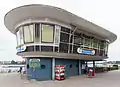
Rheinpavillon | Rathenauufer 1 Karte |
1947, 1959 | A 2588 | ||
 weitere Bilder |
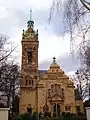
Evangelische Luther-Kirche | Reuterstraße (11) Karte |
Architekten: Johannes Vollmer, Heinrich Jassoy | 1899–1903 | A 372 | |
| Reuterstraße 1a Karte |
1880er-Jahre[1] | A 54 | ||||
| Reuterstraße 13 Karte |
1897[1] | A 681 | ||||
| Riesstraße 2 Karte |
um 1865[1] | A 2831 | ||||
| Riesstraße 6 Karte |
1866[1] | A 3132 | ||||
| Riesstraße 8 Karte |
1866[1] | A 604 | ||||
| Riesstraße 10 Karte |
1911[1] | A 2896 | ||||
| Riesstraße 11 Karte |
nach 1900[1] | A 2929 | ||||
| Riesstraße 12 Karte |
1911[1] | A 267 | ||||
| Riesstraße 14 Karte |
1911[1] | A 2906 | ||||
| Riesstraße 16 Karte |
1896[1] | A 1641 | ||||
| Riesstraße 18 Karte |
1896[1] | A 1702 | ||||
| Riesstraße 20 Karte |
1896[1] | A 1615 | ||||
| Riesstraße 21 Karte |
1880[1] | A 1714 | ||||
| Riesstraße 22 Karte |
1891[1] | A 2887 | ||||
| Riesstraße 24 Karte |
1891[1] | A 2897 | ||||
| Riesstraße 26 Karte |
1881[1] | A 2836 | ||||
| Riesstraße 28 Karte |
1881[1] | A 2901 | ||||
| Rittershausstraße 1 Karte |
Architekt: Wilhelm Weinreis[1] | 1900[1] | A 1760 | |||
| Rittershausstraße 3 Karte |
Architekt: Wilhelm Weinreis[1] | 1900[1] | A 1775 | |||
| Rittershausstraße 3a Karte |
Doppelhaus mit Nr. 5; Architekt: Carl Edler[1] | 1904[1] | A 1643 | |||
| Rittershausstraße 5 Karte |
Doppelhaus mit Nr. 3a; Architekt: Carl Edler[1] | 1904[1] | A 2728 | |||
| Rittershausstraße 6 Karte |
1901[1] | A 2584 | ||||
| Rittershausstraße 7 Karte |
1902[1] | A 2545 | ||||
| Rittershausstraße 9 Karte |
1902[1] | A 2549 | ||||
| Rittershausstraße 10 Karte |
1899[1] | A 1519 | ||||
| Rittershausstraße 11 Karte |
1902[1] | A 2548 | ||||
| Rittershausstraße 12 Karte |
1899[1] | A 1484 | ||||
| Rittershausstraße 13 Karte |
1902[1] | A 2547 | ||||
| Rittershausstraße 14 Karte |
Denkmalgeschützt: Fassade | 1902[1] | A 744 | |||
| Rittershausstraße 15 Karte |
Denkmalgeschützt: Fassade; Architekten: Kayser & von Großheim[1] | 1901/1902[1] | A 607 | |||
| Rittershausstraße 16 Karte |
1902[1] | A 2627 | ||||
| Rittershausstraße 17 Karte |
1902[1] | A 2602 | ||||
| Rittershausstraße 18 Karte |
1903[1] | A 2528 | ||||
| Rittershausstraße 19 Karte |
1902[1] | A 1673 | ||||
| Rittershausstraße 20 Karte |
1903[1] | A 1617 | ||||
| Rittershausstraße 21 Karte |
1902[1] | A 2674 | ||||
| Rittershausstraße 22 Karte |
1903[1] | A 1591 | ||||
| Rittershausstraße 23 Karte |
1902[1] | A 2597 | ||||
| Rittershausstraße 24 Karte |
1903/1904[1] | A 2541 | ||||
| Rittershausstraße 25 Karte |
1902[1] | A 2540 | ||||
 |
Rittershausstraße 26 Karte |
Doppelhaus mit Nr. 28; Architekt: Anton Butscheid[1] | 1903/1904[1] | A 1731 | ||
| Rittershausstraße 27 Karte |
1900[1] | A 2538 | ||||
|
Rittershausstraße 28 Karte |
Doppelhaus mit Nr. 26; Architekt: Anton Butscheid[1] | 1903/1904[1] | A 1732 | ||
| Rittershausstraße 29 Karte |
1900[1] | A 2656 | ||||
 |
Rittershausstraße 30 Karte |
Architekt: Anton Butscheidt[1] | 1908[1] | A 2574 | ||
| Rittershausstraße 31 Karte |
1910[1] | A 3364 | ||||
| Rittershausstraße 32 Karte |
Architekt: Anton Butscheidt[1] | 1908[1] | A 2569 | |||
| Rittershausstraße 33 Karte |
1911[1] | A 4009 | ||||
| Rittershausstraße 34 Karte |
Architekt: Anton Butscheidt[1] | 1908[1] | A 2543 | |||
 |
Gartenpavillon[9] | Schaumburg-Lippe-Straße 6[15] Karte |
1880[9] | 6. Februar 1998[9] | A 3361 | |
| Schloßstraße 1 Karte |
1882[1] | A 2007 | ||||
| Schloßstraße 2 Karte |
1907[1] | A 131 | ||||
| Wohnhaus; Gartenhäuschen[9] | Schloßstraße 4 Karte |
Denkmalgeschützt: einschließlich Vorgarten mit Einfriedung[9] | 1905 (Wohnhaus); 1904 (Gartenhäuschen)[9] | 27. Januar 1993[9] | A 2629 | |
| Schloßstraße 5 Karte |
1890[14]:318 | A 2266 | ||||
 weitere Bilder |
Schloßstraße 6 Karte |
1904[1] | A 209 | |||
| Schloßstraße 7 Karte |
1890[14]:318 | A 2252 | ||||
weitere Bilder |
Schloßstraße 8 Karte |
1904[1] | A 330 | |||
| Schloßstraße 9 Karte |
1890[14]:318[1] | A 2251 | ||||
| Schloßstraße 10 Karte |
1902[1] | A 659 | ||||
| Schloßstraße 11 Karte |
1895[1] | A 2457 | ||||
| Schloßstraße 12 Karte |
1898[1] | A 1671 | ||||
| Schloßstraße 13 Karte |
1895[1] | A 2262 | ||||
| Schloßstraße 14 Karte |
1898[1] | A 1730 | ||||
| Schloßstraße 15 Karte |
1895[1] | A 2248 | ||||
| Schloßstraße 16 Karte |
kurz nach 1900[1] | A 2255 | ||||
| Schloßstraße 17 Karte |
1902[1] | A 1541 | ||||
| Schloßstraße 18 Karte |
1901/1902[1] | A 1302 | ||||
| Schloßstraße 19 Karte |
1899[1] | A 1530 | ||||
| Schloßstraße 20 Karte |
1901/1902[1] | A 2298 | ||||
| Schloßstraße 22 Karte |
1902/1903[1] | A 133 | ||||
| Schloßstraße 24 Karte |
1902/1903[1] | A 2250 | ||||
| Schloßstraße 26 Karte |
1896[1] | A 823 | ||||
| Schloßstraße 27 Karte |
1896[1] | A 1012 | ||||
| Schloßstraße 28 Karte |
1896[1] | A 2413 | ||||
| Schloßstraße 29 Karte |
1896[1] | A 1271 | ||||
| Schloßstraße 30 Karte |
Architekt: Wilhelm Weinreis[1] | 1899[1] | A 1088 | |||
| Schloßstraße 31 Karte |
1896[1] | A 1276 | ||||
| Schloßstraße 32 Karte |
1899[1] | A 694 | ||||
| Schloßstraße 33 Karte |
1896[1] | A 1277 | ||||
| Schloßstraße 34 Karte |
1899[1] | A 2246 | ||||
| Schloßstraße 35 Karte |
1899[1] | A 702 | ||||
| Schloßstraße 36 Karte |
1899[1] | A 2245 | ||||
| Schloßstraße 37 Karte |
1899[1] | A 799 | ||||
| Schloßstraße 38 Karte |
1899[1] | A 2285 | ||||
| Schloßstraße 39 Karte |
1899[1] | A 2306 | ||||
| Schloßstraße 40 Karte |
Architekt: Carl Edler[1] | 1901[1] | A 119 | |||
| Schloßstraße 41 Karte |
1899[1] | A 2358 | ||||
| Schloßstraße 43 Karte |
1900[1] | A 2293 | ||||
| Schloßstraße 45 Karte |
1900[1] | A 1085 | ||||
| Schloßstraße 47 Karte |
1900[1] | A 476 | ||||
| Schloßstraße 49 Karte |
1898[1] | A 2267 | ||||
| Schumannstraße 1 Karte |
um 1870[1] | A 2484 | ||||
| Schumannstraße 2a Karte |
1897[1] | A 1348 | ||||
| Schumannstraße 2b Karte |
1897[1] | A 3426 | ||||
| Schumannstraße 5 Karte |
1870/1871[1] | A 840 | ||||
| Schumannstraße 7 Karte |
1870/1871[1] | A 2531 | ||||
| Schumannstraße 9 Karte |
1885[1] | A 1679 | ||||
| Schumannstraße 10 Karte |
1870er-Jahre[1] | A 2505 | ||||
| Schumannstraße 11 Karte |
1885[1] | A 1668 | ||||
| Schumannstraße 12 Karte |
1879[1] | A 1128 | ||||
| Schumannstraße 13 Karte |
1885[1] | A 2477 | ||||
| Schumannstraße 14 Karte |
1896[1] | A 621 | ||||
| Schumannstraße 16 Karte |
1896[1] | A 854 | ||||
| Schumannstraße 17 Karte |
1897[1] | A 845 | ||||
| Schumannstraße 18 Karte |
Architekten: Becker & Böhm[1] | 1889[1] | A 2803 | |||
| Schumannstraße 19 Karte |
1882[1] | A 957 | ||||
| Schumannstraße 20 Karte |
Architekten: Becker & Böhm[1] | 1891[1] | A 953 | |||
| Schumannstraße 21 Karte |
1880[1] | A 2607 | ||||
| Schumannstraße 22 Karte |
Architekten: Becker & Böhm[1] | 1891[16][1] | September 1989[16] | A 1606 | ||
| Schumannstraße 23 Karte |
1902[1] | A 1636 | ||||
| Schumannstraße 24 Karte |
1894[1] | A 2802 | ||||
| Schumannstraße 25 Karte |
1885[1] | A 2533 | ||||
| Schumannstraße 26 Karte |
1894[1] | A 2458 | ||||
| Schumannstraße 27 Karte |
1884[1] | A 1774 | ||||
| Schumannstraße 28 Karte |
1895[1] | A 677 | ||||
| Schumannstraße 29 Karte |
1884[1] | A 1773 | ||||
| Schumannstraße 31 Karte |
1884[1] | A 1767 | ||||
| Schumannstraße 32 Karte |
1901/1903[1] | A 1728 | ||||
| Schumannstraße 34 Karte |
1901/1903[1] | A 2516 | ||||
| Schumannstraße 35 Karte |
1906/1907[1] | A 2463 | ||||
| Schumannstraße 36 Karte |
1901/1903[1] | A 2462 | ||||
| Schumannstraße 37 Karte |
1906/1907[1] | A 2433 | ||||
| Schumannstraße 38 Karte |
1901[1] | A 718 | ||||
| Schumannstraße 39 Karte |
1886[1] | A 1697 | ||||
| Schumannstraße 40 Karte |
1901[1] | A 2465 | ||||
| Schumannstraße 41 Karte |
1886[1] | A 2536 | ||||
| Schumannstraße 43 Karte |
1886[1] | A 716 | ||||
| Schumannstraße 45 Karte |
1886[1] | A 2448 | ||||
| Schumannstraße 47 Karte |
1885[1] | A 1472 | ||||
| Schumannstraße 49 Karte |
1877[1] | A 2452 | ||||
| Schumannstraße 51 Karte |
Architekt: Carl Edler[1] | 1903[1] | A 1513 | |||
| Schumannstraße 53 Karte |
1900[1] | A 63 | ||||
| Schumannstraße 54 Karte |
Doppelhaus mit Nr. 56; Architekt: Carl Edler[1] | 1901[1] | A 1324 | |||
| Schumannstraße 55 Karte |
1904[1] | A 2628 | ||||
| Schumannstraße 56 Karte |
Doppelhaus mit Nr. 54; Architekt: Carl Edler[1] | 1901[1] | A 1325 | |||
| Schumannstraße 57 Karte |
Architekt: Carl Edler[1] | 1901[1] | A 720 | |||
| Schumannstraße 57a Karte |
A 2487 | |||||
| Schumannstraße 59 Karte |
1895[1] | A 2609 | ||||
| Schumannstraße 61 Karte |
1895[1] | A 2623 | ||||
| Schumannstraße 62 Karte |
1902[1] | A 2563 | ||||
| Schumannstraße 63 Karte |
Architekt: Hermann Schmitt[1] | 1894[1] | A 2523 | |||
| Schumannstraße 66 Karte |
A 2731 | |||||
| Schumannstraße 67 Karte |
Architekt: Hermann Schmitt[1] | 1893[1] | A 1119 | |||
| Schumannstraße 69 Karte |
Architekt: Hermann Schmitt[1] | 1892[1] | A 2751 | |||
| Schumannstraße 70 Karte |
1892[1] | A 975 | ||||
| Schumannstraße 72 Karte |
1897[1] | A 2450 | ||||
| Schumannstraße 73 Karte |
A 2711 | |||||
| Schumannstraße 78 Karte |
Teil der Hausgruppe Schumannstraße 78/80[17] | 1930/1931[17] | A 4146 | |||
| Schumannstraße 80 Karte |
Teil der Hausgruppe Schumannstraße 78/80[17] | 1930/1931[17] | A 4145 | |||
| Schumannstraße 82 Karte |
1890er-Jahre[1] | A 1289 | ||||
| Schumannstraße 84 Karte |
1890er-Jahre[1] | A 2500 | ||||
| Schumannstraße 86 Karte |
1890er-Jahre[1] | A 2884 | ||||
| Schumannstraße 90 Karte |
1912[1] | A 1023 | ||||
| Schumannstraße 92 Karte |
Architekt: Karl Thoma[18] | 1925[18] | A 2992 | |||
| Schumannstraße 98 Karte |
Architekt: Anton Butscheidt[1] | 1912[1] | A 2441 | |||
| Schumannstraße 100 Karte |
Architekt: Anton Butscheidt[1] | 1911/1913[1] | A 2562 | |||
| Schumannstraße 102 Karte |
Architekt: Anton Butscheidt[1] | 1911[1] | A 2466 | |||
| Schumannstraße 110 Karte |
Doppelhaus mit Nr. 112;[9] Architekt: Anton Butscheidt[1] | 1910[9] | A 991 | |||
| Wohnhaus[9] | Schumannstraße 112 Karte |
Doppelhaus mit Nr. 110;[9] Architekt: Anton Butscheidt[9] | 1910[9] | 1. Oktober 1992[9] | A 2524 | |
| Schumannstraße 114 Karte |
Doppelhaus mit Nr. 116; Architekt: Anton Butscheidt[1] | 1910[1] | A 187 | |||
| Schumannstraße 116 Karte |
Doppelhaus mit Nr. 114; Denkmalgeschützt: Fassade; Architekt: Anton Butscheidt[1] | 1910[1] | A 56 | |||
| Schumannstraße 118 Karte |
Architekt: Anton Butscheidt[1] | 1910[1] | A 2571 | |||
 weitere Bilder |
Venusbergweg 1 Karte |
erbaut für den damaligen Bürgermeister von Poppelsdorf[19] | zwischen 1865 und 1870[1][19] | A 897 | ||
 |
Venusbergweg 1a Karte |
1897[1] | A 1054 | |||
| Venusbergweg 3 Karte |
1870er-Jahre[1] | A 3375 | ||||
| Venusbergweg 5 Karte |
1870er-Jahre[1] | A 2294 | ||||
| Venusbergweg 8 Karte |
Architekt: Carl Edler[1] | 1903[1] | A 2279 | |||
| Venusbergweg 9 Karte |
1897[1] | A 2288 | ||||
 |
Venusbergweg 10 Karte |
Architekt: Carl Edler[1] | 1903[1] | A 2282 | ||
| Venusbergweg 11 Karte |
1892[1] | A 2546 | ||||
| Venusbergweg 12 Karte |
1900[1] | A 2341 | ||||
| Venusbergweg 14 Karte |
1900[1] | A 2264 | ||||
 |
Venusbergweg 16 Karte |
Architekt: Carl Edler[1] | 1903[1] | A 856 | ||
 |
Venusbergweg 17 Karte |
Denkmalgeschützt: Fassade; Doppelhaus mit Nr. 17a; Architekt: Karl Thoma[1] | 1914/1915[1] | A 746 | ||
|
Venusbergweg 17a Karte |
Doppelhaus mit Nr. 17; Architekt: Karl Thoma[1] | 1914/1915[1] | A 2324 | ||
| Venusbergweg 18 Karte |
1903[1] | A 1070 | ||||
| Venusbergweg 19 Karte |
1914[1] | A 2311 | ||||
| Venusbergweg 20 Karte |
1897/1898[1] | A 1621 | ||||
| Venusbergweg 21 Karte |
1914[1] | A 2316 | ||||
| Venusbergweg 33 Karte |
1907[1] | A 224 | ||||
| Venusbergweg 34 Karte |
1884[1] | A 2270 | ||||
| Venusbergweg 35 Karte |
1884[1] | A 2394 | ||||
| Venusbergweg 36 Karte |
1884[1] | A 2265 | ||||
| Venusbergweg 37 Karte |
1884[1] | A 1284 | ||||
| Venusbergweg 38 Karte |
1897[1] | A 1004 | ||||
| Venusbergweg 39 Karte |
1897[1] | A 2290 | ||||
| Venusbergweg 40 Karte |
1890[1] | A 2313 | ||||
| Venusbergweg 41 Karte |
Architekten: Becker & Böhm[1] | 1887[1] | A 2283 | |||
| Venusbergweg 42 Karte |
Architekten: Becker & Böhm[1] | 1887[1] | A 2556 | |||
| Venusbergweg 43 Karte |
1892[1] | A 2555 | ||||
| Venusbergweg 44 Karte |
1892[1] | A 2383 | ||||
| Venusbergweg 45 Karte |
1893[1] | A 633 | ||||
| Venusbergweg 46 Karte |
1893[1] | A 2402 | ||||
| Venusbergweg 47 Karte |
1892[1] | A 2307 | ||||
| Venusbergweg 48 Karte |
1892[1] | A 2683 | ||||
| Venusbergweg 49 Karte |
1887[1] | A 2705 | ||||
| Venusbergweg 50 Karte |
1887[1] | A 2757 | ||||
| Weberstraße 10 Karte |
vor 1870[1] | A 2762 | ||||
| Weberstraße 12 Karte |
A 2676 | |||||
| Weberstraße 14 Karte |
1871[1] | A 2335 | ||||
| Weberstraße 18b Karte |
vor 1870[1] | A 2326 | ||||
| Weberstraße 28 Karte |
A 2327 | |||||
| Weberstraße 34 Karte |
1857[1] | A 2322 | ||||
| Weberstraße 36 Karte |
1857[1] | A 2364 | ||||
| Weberstraße 38 Karte |
1857[1] | A 2430 | ||||
| Weberstraße 40 Karte |
1854[1] | A 2704 | ||||
| Weberstraße 41 Karte |
1875/1876[1] | A 631 | ||||
| Weberstraße 42 Karte |
1854[1] | A 2344 | ||||
| Weberstraße 43 Karte |
1896[1] | A 862 | ||||
| Weberstraße 44 Karte |
1854[1] | A 2329 | ||||
| Weberstraße 45 Karte |
1896[1] | A 2375 | ||||
| Weberstraße 46 Karte |
vor 1870[1] | A 2343 | ||||
| Weberstraße 47 Karte |
1860, 1899 (Umbau)[1] | A 2362 | ||||
| Weberstraße 48 Karte |
vor 1870[1] | A 2473 | ||||
| Weberstraße 50 Karte |
vor 1870[1] | A 2973 | ||||
| Weberstraße 50a/ Kaiserstraße 87 Karte |
A 3869 | |||||
| Weberstraße 51 Karte |
1896[1] | A 1577 | ||||
| Weberstraße 52 Karte |
1900[1] | A 202 | ||||
| Weberstraße 53 Karte |
1896[1] | A 1537 | ||||
| Weberstraße 54 Karte |
1900[1] | A 1981 | ||||
| Weberstraße 55 Karte |
1854[1] | A 622 | ||||
| Weberstraße 56 Karte |
1900[1] | A 1558 | ||||
.jpg.webp) |
Weberstraße 57 Karte |
Architekt: Paul Richard Thomann[1] | 1850er-Jahre[1] | A 2360 | ||
 weitere Bilder |
Weberstraße 59/59a–61 Karte |
Architekt (Nr. 61): Heinrich Roettgen;[1] heute „Haus der Kultur“ | 1883 (Nr. 59/59a), 1911 (Nr. 61)[1] | A 672 | ||
| Weberstraße 63 Karte |
1874[1] | A 646 | ||||
| Weberstraße 65 Karte |
1875[1] | A 2407 | ||||
| Weberstraße 67 Karte |
1870er-Jahre[1] | A 2525 | ||||
| Weberstraße 71 Karte |
1892[1] | A 2202 | ||||
| Weberstraße 73 Karte |
Architekt: Johann Schwister[1] | 1897/1898[1] | A 648 | |||
| Weberstraße 75 Karte |
Architekt: Johann Schwister[1] | 1897/1898[1] | A 2200 | |||
| Weberstraße 77 Karte |
1902[1][20] | A 2201 | ||||
| Weberstraße 79 Karte |
1906[1] | A 2199 | ||||
| Weberstraße 82 Karte |
1875[1] | A 655 | ||||
| Weberstraße 83 Karte |
Architekt: Carl Edler[1] | 1906[1] | A 2161 | |||
| Weberstraße 84 Karte |
1887[1] | A 2331 | ||||
| Weberstraße 85 Karte |
1891[1] | A 3379 | ||||
| Weberstraße 86 Karte |
1874[1] | A 2471 | ||||
| Weberstraße 87 Karte |
1891[1] | A 2554 | ||||
| Weberstraße 88 Karte |
1873[1] | A 2183 | ||||
| Weberstraße 89 Karte |
A 1687 | |||||
| Weberstraße 90 Karte |
1873[1] | A 1894 | ||||
| Weberstraße 91 Karte |
A 1234 | |||||
| Weberstraße 92 Karte |
1873[1] | A 760 | ||||
| Weberstraße 93 Karte |
1894[1] | A 2225 | ||||
| Weberstraße 94 Karte |
1872[1] | A 2334 | ||||
| Weberstraße 95 Karte |
1894[1] | A 2224 | ||||
| Weberstraße 96 Karte |
1871[1] | A 1875 | ||||
| Wohnhaus[9] | Weberstraße 97 Karte |
mit originaler Vorgarteneinfriedung[9] | 1894[9] | 12. Dezember 1991[9] | A 2232 | |
| Weberstraße 98 Karte |
1912[1] | A 2426 | ||||
| Weberstraße 99 Karte |
1894[1] | A 1005 | ||||
| Weberstraße 101 Karte |
1894[1] | A 466 | ||||
| Weberstraße 102 Karte |
1871[1] | A 69 | ||||
| Weberstraße 103 Karte |
Teil der Hausgruppe Weberstraße 103–107; Architekt: Johann Schwister[1] | 1893/1894[1] | A 2284 | |||
| Weberstraße 104 Karte |
1871[1] | A 2491 | ||||
| Weberstraße 105 Karte |
Teil der Hausgruppe Weberstraße 103–107; Architekt: Johann Schwister[1] | 1893/1894[1] | A 2626 | |||
| Weberstraße 106 Karte |
1871[1] | A 1318 | ||||
| Weberstraße 107 Karte |
Teil der Hausgruppe Weberstraße 103–107; Architekt: Johann Schwister[1] | 1893/1894[1] | A 2414 | |||
| Weberstraße 108 Karte |
1871[1] | A 1044 | ||||
| Weberstraße 109 Karte |
1897[1] | A 682 | ||||
| Weberstraße 110 Karte |
1871[1] | A 2336 | ||||
| Weberstraße 112 Karte |
1871[1] | A 2479 | ||||
| Weberstraße 114 Karte |
1880[1] | A 2490 | ||||
| Weberstraße 120 Karte |
A 2286 | |||||
| Weberstraße 122 Karte |
A 2221 | |||||
| Weberstraße 126 Karte |
A 2223 | |||||
| Weberstraße 128 Karte |
A 1229 | |||||
| Weberstraße 130 Karte |
A 1459 | |||||
| Weberstraße 132 Karte |
A 2301 | |||||
| Weberstraße 134 Karte |
A 1147 | |||||
| Wilhelm-Levison-Straße 1 Karte |
1896[1] | A 1500 | ||||
| Wilhelm-Levison-Straße 1a Karte |
1899[1] | A 2169 | ||||
| Wilhelm-Levison-Straße 2 Karte |
Architekt: Wilhelm Weinreis[1] | 1899[1] | A 2175 | |||
| Wilhelm-Levison-Straße 3 Karte |
1899[1] | A 2023 | ||||
| Wilhelm-Levison-Straße 4 Karte |
Architekt: Wilhelm Weinreis[1] | 1899[1] | A 938 | |||
| Wilhelm-Levison-Straße 5 Karte |
1899[1] | A 2187 | ||||
| Wilhelm-Levison-Straße 5a Karte |
1899[1] | A 1528 | ||||
| Wilhelm-Levison-Straße 6 Karte |
Architekt: Wilhelm Weinreis[1] | 1899[1] | A 2238 | |||
| Wilhelm-Levison-Straße 7 Karte |
um 1895[1] | A 707 | ||||
| Wilhelm-Levison-Straße 8 Karte |
1896/1897[1] | A 1758 | ||||
| Wilhelm-Levison-Straße 9 Karte |
um 1895[1] | A 2486 | ||||
| Wilhelm-Levison-Straße 10 Karte |
1896/1897[1] | A 2553 | ||||
| Wilhelm-Levison-Straße 11 Karte |
1893[1] | A 108 | ||||
| Wilhelm-Levison-Straße 12 Karte |
1898[1] | A 1490 | ||||
| Wilhelm-Levison-Straße 13 Karte |
1893[1] | A 2171 | ||||
| Wilhelm-Levison-Straße 14 Karte |
Architekt: Wilhelm Weinreis[1] | 1902[1] | A 2211 | |||
| Wilhelm-Levison-Straße 15 Karte |
1893[1] | A 2309 | ||||
| Wilhelm-Levison-Straße 16 Karte |
Architekt: Wilhelm Weinreis[1] | 1902[1] | A 2376 | |||
| Wilhelm-Levison-Straße 17 Karte |
1895[1] | A 2308 | ||||
| Wilhelm-Levison-Straße 18 Karte |
Architekt: Wilhelm Weinreis[1] | 1902[1] | A 1754 | |||
| Wilhelm-Levison-Straße 19 Karte |
1895[1] | A 2191 | ||||
| Wilhelm-Levison-Straße 20 Karte |
1895[1] | A 2532 | ||||
| Wilhelm-Levison-Straße 21 Karte |
1895[1] | A 619 | ||||
| Wilhelm-Levison-Straße 22 Karte |
Architekt: Johann Schwister[1] | 1900[1] | A 2154 | |||
| Wilhelm-Levison-Straße 23 Karte |
1895[1] | A 726 | ||||
| Wilhelm-Levison-Straße 25 Karte |
A 2236 | |||||
| Wilhelm-Levison-Straße 27 Karte |
1895[1] | A 2247 | ||||
| Wilhelm-Levison-Straße 29 Karte |
1894[1] | A 2397 | ||||
| Wilhelm-Levison-Straße 31 Karte |
1894[1] | A 2005 | ||||
| Wilhelm-Levison-Straße 33 Karte |
1894[1] | A 1083 | ||||
| Wilhelm-Levison-Straße 35 Karte |
1894[1] | A 2162 | ||||
| Wilhelm-Levison-Straße 37 Karte |
1894[1] | A 2237 | ||||
| Wilhelm-Levison-Straße 39 Karte |
1894[1] | A 879 |
Weblinks
Einzelnachweise und Anmerkungen
- Landeskonservator Rheinland (Hrsg.); Eberhard Grunsky, Volker Osteneck: Die Bonner Südstadt (=Arbeitsheft 6). Zweite, veränderte Auflage, Rheinland-Verlag, Köln 1976, ISBN 3-7927-0265-7, S. 9–21.
- Beschlussvorlage (PDF) Bonner Ratsinformationssystem
- Josef Niesen: Rudolf Carl Julius Schultze. Portal Rheinische Geschichte, 17. April 2014
- Schulgeschichte, Clara-Schumann-Gymnasium
- Olga Sonntag: Villen am Bonner Rheinufer: 1819–1914. Bouvier Verlag, Bonn 1998, ISBN 3-416-02618-7, Band 1, S. 97. (zugleich Dissertation Universität Bonn, 1994)
- Wiltrud Petsch, Joachim Petsch: Bundesrepublik, eine neue Heimat?: Städtebau und Architektur nach '45. Verlag für Ausbildung und Studium in der Elefanten Press, 1983, S. 145.
- Franz Josef Talbot (mit Fotografien von Achim Bednorz): Bonner Südstadt. Emons Verlag, Köln 2018, ISBN 978-3-7408-0468-8, S. 212.
- Tuya Roth: Hans Schafgans. Fotografien Bonner Architektur der fünfziger und sechziger Jahre, Dissertation, Bonn 2007, urn:nbn:de:hbz:5-11557. S. 80, 154.
- Die Angaben sind der rechtswirksamen Denkmalliste der Stadt Bonn entnommen. Sie wird von der Unteren Denkmalbehörde geführt, von der die Einträge zu den einzelnen Denkmälern kostenpflichtig bezogen werden können.
- Rudolf Agstner: Vertretung – Botschaft – Außenstelle: ein Nachruf auf Österreichs diplomatische Mission in Bonn 1950 bis 2006. In: Bonner Heimat- und Geschichtsverein, Stadtarchiv Bonn (Hrsg.): Bonner Geschichtsblätter. Jahrbuch des Bonner Heimat- und Geschichtsvereins, Band 55/56, Bonn 2006, ISSN 0068-0052, S. 303.
- Franz Josef Talbot (mit Fotografien von Achim Bednorz): Bonner Südstadt. Emons Verlag, Köln 2018, ISBN 978-3-7408-0468-8, S. 86.
- Der Oberbürgermeister der Bundesstadt Bonn, Stadtplanungsamt – Untere Denkmalbehörde/Presseamt: Tag des offenen Denkmals, 14. September 2014. August 2014 (PDF)
- Eberhard Grunsky: Ein bürgerliches Wohngebiet der Gründerzeit: Zur Geschichte und zum Denkmalwert der Bonner Südstadt. In: Bonner Heimat- und Geschichtsverein, Stadtarchiv Bonn (Hrsg.): Bonner Geschichtsblätter: Jahrbuch des Bonner Heimat- und Geschichtsvereins, ISSN 0068-0052, Band 27, Bonn 1975, S. 191–208 (hier: S. 203, Abb. 50).
- Birgitta Gruber-Corr: Stadterweiterung im Rheinland – Kommune, Bürger und Staat als Akteure im Entstehungsprozess der Bonner Südstadt 1855–1890. Veröffentlichungen des Stadtarchivs Bonn, Band 64, Bonn 2004 (=Inaugural-Dissertation zur Erlangung der Doktorwürde der Philosophischen Fakultät der Rheinischen Friedrich-Wilhelms-Universität zu Bonn, Bonn 2001) (online).
- ehemals Adenauerallee 63
- ‚Goldener Hirsch‘ wird ein Denkmal, General-Anzeiger, 15. September 1989, Stadtausgabe Bonn, S. 5
- Franz Josef Talbot (mit Fotografien von Achim Bednorz): Bonner Südstadt. Emons Verlag, Köln 2018, ISBN 978-3-7408-0468-8, S. 200.
- Franz Josef Talbot (mit Fotografien von Achim Bednorz): Bonner Südstadt. Emons Verlag, Köln 2018, ISBN 978-3-7408-0468-8, S. 197.
- Franz Josef Talbot (mit Fotografien von Achim Bednorz): Bonner Südstadt. Emons Verlag, Köln 2018, ISBN 978-3-7408-0468-8, S. 81.
- Inschrift am Gebäude
Alt-Godesberg | Auerberg | Beuel-Mitte | Beuel-Ost | Bonn-Castell | Bonn-Zentrum | Brüser Berg | Buschdorf | Dottendorf | Dransdorf | Duisdorf | Endenich | Friesdorf | Geislar | Godesberg-Nord | Godesberg-Villenviertel | Graurheindorf | Gronau | Hardthöhe | Heiderhof | Hochkreuz | Hoholz | Holtorf | Holzlar | Ippendorf | Kessenich | Küdinghoven | Lannesdorf | Lengsdorf | Lessenich/Meßdorf | Limperich | Mehlem | Muffendorf | Nordstadt | Oberkassel | Pennenfeld | Plittersdorf | Poppelsdorf | Pützchen/Bechlinghoven | Ramersdorf | Röttgen | Rüngsdorf | Schwarzrheindorf/Vilich-Rheindorf | Schweinheim | Südstadt (A–K; L–Z) | Tannenbusch | Ückesdorf | Venusberg | Vilich | Vilich-Müldorf | Weststadt