Kanton Montecristi
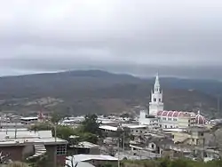
Der Kanton Montecristi befindet sich in der Provinz Manabí im Westen von Ecuador. Er besitzt eine Fläche von 738,6 km². Im Jahr 2020 lag die Einwohnerzahl schätzungsweise bei 107.780. Verwaltungssitz des Kantons ist die Stadt Montecristi mit 46.312 Einwohnern (Stand 2010). Der Kanton Montecristi wurde am 25. Juni 1824 eingerichtet.
| Kanton Montecristi | |||
|---|---|---|---|
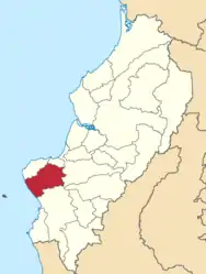 Der Kanton Montecristi (rot markiert) in der Provinz Manabí | |||
| Symbole | |||
| |||
| Basisdaten | |||
| Staat | Ecuador | ||
| Provinz | Manabí | ||
| Sitz | Montecristi | ||
| Fläche | 738,6 km² | ||
| Einwohner | 107.780 (Schätzung 2020) | ||
| Dichte | 146 Einwohner pro km² | ||
| Gründung | 25. Juni 1824 | ||
| ISO 3166-2 | EC-M | ||
| Webauftritt | montecristi.gob.ec (es) | ||
| Politik | |||
| Alcalde | Wilver Washington Arteaga Palacios (2019–2023) | ||
 | |||


Lage
Der Kanton Montecristi liegt im Südwesten der Provinz Manabí. Der Kanton liegt an der Pazifikküste. Zu ihm gehört die 25 km vor der Küste gelegene Insel Isla de la Plata. Der Hauptort Montecristi liegt 12 km südlich der Stadt Manta im Küstenhinterland. Die Fernstraße E30 (Portoviejo–Manta) führt an Montecristi vorbei.
Der Kanton Montecristi grenzt im Norden an den Kanton Manta, im Nordosten an den Kanton Jaramijó, im Osten an den Kanton Sucre sowie im Süden an den Kanton Jipijapa.
Verwaltungsgliederung
Der Kanton Montecristi ist in die Parroquias urbanas („städtisches Kirchspiel“)
- Aníbal San Andrés
- Colorado
- General Alfaro
- Leonidas Proaño
- Isabel Muentes
- Montecristi
und in die Parroquia rural („ländliches Kirchspiel“)
gegliedert.
Weblinks
- https://montecristi.gob.ec/ – GAD Municipal del Cantón Montecristi
- Bevölkerungsstatistik bei www.citypopulation.de
24 de Mayo | Bolívar | Chone | El Carmen | Flavio Alfaro | Jama | Jaramijó | Jipijapa | Junín | Manta | Montecristi | Olmedo | Paján | Pedernales | Pichincha | Portoviejo | Puerto López | Rocafuerte | San Vicente | Santa Ana | Sucre | Tosagua