Kanton Giromagny
Der Kanton Giromagny ist ein französischer Wahlkreis im Département Territoire de Belfort in der Region Bourgogne-Franche-Comté. Er umfasst 22 Gemeinden; Hauptort ist Giromagny. Vertreterin im conseil général des Départements ist seit 2001 Marie-Christine Peureux.
| Kanton Giromagny | |
|---|---|
| Region | Bourgogne-Franche-Comté |
| Département | Territoire de Belfort |
| Arrondissement | Belfort |
| Hauptort | Giromagny |
| Einwohner | 15.145 (1. Jan. 2019) |
| Bevölkerungsdichte | 87 Einw./km² |
| Fläche | 174,27 km² |
| Gemeinden | 22 |
| INSEE-Code | 9007 |
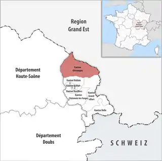 Lage des Kantons Giromagny im Département Territoire de Belfort | |
Gemeinden
Der Kanton besteht aus 22 Gemeinden mit insgesamt 15.145 Einwohnern (Stand: 1. Januar 2019) auf einer Gesamtfläche von 174,27 km²:
| Gemeinde | Einwohner 1. Januar 2019 |
Fläche km² |
Dichte Einw./km² |
Code INSEE |
Postleitzahl |
|---|---|---|---|---|---|
| Anjoutey | 589 | 7,72 | 76 | 90003 | 90170 |
| Auxelles-Bas | 453 | 9,29 | 49 | 90005 | 90200 |
| Auxelles-Haut | 286 | 6,51 | 44 | 90006 | 90200 |
| Bourg-sous-Châtelet | 123 | 0,87 | 141 | 90016 | 90110 |
| Chaux | 1.164 | 9,42 | 124 | 90023 | 90330 |
| Étueffont | 1.430 | 12,54 | 114 | 90041 | 90170 |
| Felon | 239 | 4,04 | 59 | 90044 | 90110 |
| Giromagny | 2.929 | 5,67 | 517 | 90052 | 90200 |
| Grosmagny | 521 | 8,96 | 58 | 90054 | 90200 |
| Lachapelle-sous-Chaux | 746 | 10,94 | 68 | 90057 | 90300 |
| Lachapelle-sous-Rougemont | 580 | 4,94 | 117 | 90058 | 90360 |
| Lamadeleine-Val-des-Anges | 43 | 6,43 | 7 | 90061 | 90170 |
| Lepuix | 1.156 | 28,32 | 41 | 90065 | 90200 |
| Leval | 242 | 6,08 | 40 | 90066 | 90110 |
| Petitefontaine | 189 | 3,15 | 60 | 90078 | 90360 |
| Petitmagny | 314 | 2,21 | 142 | 90079 | 90170 |
| Riervescemont | 95 | 8,51 | 11 | 90085 | 90200 |
| Romagny-sous-Rougemont | 221 | 2,53 | 87 | 90086 | 90110 |
| Rougegoutte | 966 | 8,38 | 115 | 90088 | 90200 |
| Rougemont-le-Château | 1.497 | 16,81 | 89 | 90089 | 90110 |
| Saint-Germain-le-Châtelet | 643 | 3,40 | 189 | 90091 | 90110 |
| Vescemont | 719 | 7,55 | 95 | 90102 | 90200 |
| Kanton Giromagny | 15.145 | 174,27 | 87 | 9007 | – |
Bis zur landesweiten Neuordnung der französischen Kantone im März 2015 gehörten zum Kanton Giromagny die 13 Gemeinden Auxelles-Bas, Auxelles-Haut, Chaux, Évette-Salbert, Giromagny, Grosmagny, Lachapelle-sous-Chaux, Lepuix, Petitmagny, Riervescemont, Rougegoutte, Sermamagny und Vescemont. Sein Zuschnitt entsprach einer Fläche von 124 km km2. Er besaß vor 2015 den anderen INSEE-Code 9004.