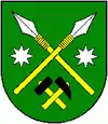
Hôrka
Hôrka (bis 1948 slowakisch „Horka“; deutsch Horke, ungarisch Lándzsásötfalu – 1898 bis 1902 Landsásfalu – vorher Horka) ist eine Gemeinde in der Ostslowakei.
| Hôrka | |||
|---|---|---|---|
| Wappen | Karte | ||
 |
| ||
| Basisdaten | |||
| Staat: | Slowakei | ||
| Kraj: | Prešovský kraj | ||
| Okres: | Poprad | ||
| Region: | Tatry | ||
| Fläche: | 11,30 km² | ||
| Einwohner: | 2.098 (31. Dez. 2020) | ||
| Bevölkerungsdichte: | 186 Einwohner je km² | ||
| Höhe: | 610 m n.m. | ||
| Postleitzahl: | 059 12 | ||
| Telefonvorwahl: | 0 52 | ||
| Geographische Lage: | 49° 1′ N, 20° 24′ O | ||
| Kfz-Kennzeichen: | PP | ||
| Kód obce: | 523488 | ||
| Struktur | |||
| Gemeindeart: | Gemeinde | ||
| Gliederung Gemeindegebiet: | 4 Gemeindeteile | ||
| Verwaltung (Stand: November 2018) | |||
| Bürgermeister: | Helena Mihalčinová | ||
| Adresse: | Obecný úrad Hôrka 141 05912 Hôrka | ||
| Statistikinformation auf statistics.sk | |||
Zur 1347 erstmals schriftlich erwähnten Ort gehören die nach 1898 eingemeindeten Orte Kišovce (deutsch Kischensdorf), Miklušovce (deutsch Nickelsdorf, kein eigener Gemeindeteil mehr), Prímovce (deutsch Primsdorf) und (Svätý) Ondrej (deutsch Sankt Andrä).
Weblinks
Commons: Hôrka – Sammlung von Bildern, Videos und Audiodateien
This article is issued from Wikipedia. The text is licensed under Creative Commons - Attribution - Sharealike. The authors of the article are listed here. Additional terms may apply for the media files, click on images to show image meta data.
