Amenal
| Gemeinde O Pino: Amenal | |||
|---|---|---|---|
| Wappen | Karte von Spanien | ||
| ? Hilfe zu Wappen |
| ||
| Basisdaten | |||
| Autonome Gemeinschaft: | |||
| Provinz: | A Coruña | ||
| Koordinaten | 42° 54′ N, 8° 24′ W | ||
| Höhe: | 240 msnm | ||
| Einwohner: | 90 (1. Januar 2011)INE | ||
| Postleitzahl: | 15887 | ||
| Ortskennzahl: | 15066120300 | ||
| Nächster Flughafen: | Flughafen Santiago de Compostela | ||
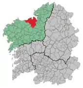
| Lage des Ortes | |||
 | |||


Amenal ist ein Ort am Jakobsweg in der Provinz A Coruña der Autonomen Gemeinschaft Galicien, administrativ ist er von O Pino abhängig.
Literatur
- Míllan Bravo Lozano: Praktischer Pilgerführer. Der Jakobsweg. Editorial Everest, Léon 1994, ISBN 84-241-3835-X.
Quellen
- Bevölkerungszahlen siehe INE
- Postleitzahlen auf Ingeniuz.com
- Koordinaten und Höhenangaben siehe Google Earth
Navigationsleiste Jakobsweg „Camino Francés“
← Vorhergehender Ort: Santa Irene 5,8 km | Amenal | Nächster Ort: Lavacolla 5 km →
This article is issued from Wikipedia. The text is licensed under Creative Commons - Attribution - Sharealike. The authors of the article are listed here. Additional terms may apply for the media files, click on images to show image meta data.