South Oxfordshire
South Oxfordshire ist ein District in der Grafschaft Oxfordshire in England. Verwaltungssitz ist Wallingford; weitere bedeutende Orte sind Didcot, Henley-on-Thames und Thame.
| South Oxfordshire District | |
|---|---|
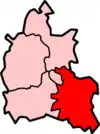 Lage in Oxfordshire | |
| Status | District |
| Region | South East England |
| Verw.grafschaft | Oxfordshire |
| Verwaltungssitz | Wallingford |
| Fläche | 678,53 km² (57.) |
| Einwohner | 128.400 (153.) |
| ONS-Code | 38UD |
| Website | www.southoxon.gov.uk |
Geschichte
Der Bezirk wurde am 1. April 1974 gebildet und entstand aus der Fusion der Municipal Boroughs Henley-on-Thames und Wallingford, des Urban District Thame sowie der Rural Districts Bullingdon, Henley und Wallingford. Das Gebiet um Wallingford gehörte zuvor zur Verwaltungsgrafschaft Berkshire.
Gliederung
Der Bezirk gliedert sich in 87 Gemeinden (Civil Parish):
|
|
|
Von diesen haben 75 einen eigenen, Aston Tirrold und Aston Upthorpe einen gemeinsamen Gemeinderat (Parish Council). Die übrigen 11 haben kein derartiges Gremium, stattdessen finden Einwohnerversammlungen statt. Didcot, Henley-on-Thames, Thame und Wallingford sind Kleinstädte (Town), dementsprechend heißt der Rat dort Town Council.[1]
Weblinks
- Offizielle Website des District Councils (englisch)
- Statistische Daten auf Basis der Volkszählung 2011 auf der Website des Office for National Statistics (englisch)
- District South Oxfordshire in der Datenbank des Ordnance Survey (englisch)
Einzelnachweise
- Parish council contact details auf der Website des Districts, abgerufen am 29. März 2018 (englisch)