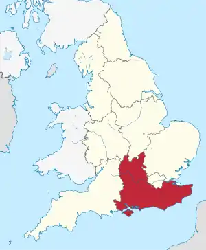
South East England
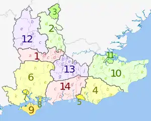
South East England (englisch für Südostengland) ist eine der neun Regionen Englands. Der Sitz der Verwaltungsbehörden ist in Guildford. Zu dieser Region gehören sechs Verwaltungsgrafschaften (non-metropolitan Countys)[2] und dreizehn Unitary Authorities (selbständige Stadtkreise).[2]
| South East England | |
|---|---|
 Karte | |
| Geografie | |
| Fläche | 19.096 km² |
| Verwaltungssitz | Guildford |
| Demografie | |
| Bevölkerung Bevölkerungsdichte | 8.724.737 (2012)[1] 457 Einwohner/km² |
Im Vergleich mit dem BIP der EU ausgedrückt in Kaufkraftstandards erreicht die Region einen Index von 118 (EU-28=100) (2015) und ist damit nach London die wohlhabendste des Landes.[3]
Weblinks
- Tourism South East (englisch)
- Traveline South East Journey Planner (englisch)
Einzelnachweise
- Bevölkerung von England und Wales am 30. Juni 2012 (ZIP, 832 kB)
- 2011 Census: Local authorities in the United Kingdom (Office for National Statistics)
- Eurostat. (PDF) Abgerufen am 22. August 2018.
This article is issued from Wikipedia. The text is licensed under Creative Commons - Attribution - Sharealike. The authors of the article are listed here. Additional terms may apply for the media files, click on images to show image meta data.