Sanarate
Sanarate ist eine rund 10.000 Einwohner zählende Kleinstadt und ein Municipio im Departamento El Progreso in Guatemala. Sie liegt etwa 55 km nordöstlich von Guatemala-Stadt und 25 km südwestlich von Guastatoya auf rund 800 m Höhe. In Monte Grande (Cerro Grande), drei Kilometer nordwestlich von Sanarate, zweigt von der Atlantikfernstraße CA 9 die Nationalstraße 19 nach Südosten ab, welche über Sanarate und Sansare nach Jalapa und Jutiapa führt. Sanarate hat einen Bahnhof an der seit 2007 stillgelegten Bahnstrecke Puerto San José – Puerto Barrios.
| Sanarate | ||
|---|---|---|
|
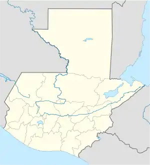
Sanarate auf der Karte von Guatemala | ||
| Basisdaten | ||
| Staat | Guatemala | |
| Departamento | El Progreso | |
| Einwohner | 33.025 (2002) | |
| – im Ballungsraum | 10.000 | |
| Detaildaten | ||
| Fläche | 273 km2 | |
| Bevölkerungsdichte | 121 Ew./km2 | |
| Höhe | 803 m | |
| Gewässer | Río Motagua Río Plátanos | |
| Zeitzone | UTC−6 | |
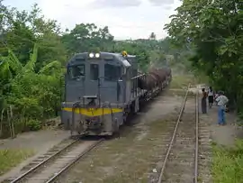 Güterzug in Sanarate | ||
Das 273 km² große Municipio erstreckt sich vom Tal des Río Motagua im Nordwesten bis ins südliche Hügelland von El Progreso. Das Municipio hat insgesamt etwa 35.000 Einwohner, von denen ein Großteil in ländlichen Siedlungen und Dörfern lebt, darunter El Upayón, San Juan, Agua Salóbrega, Sansirisay El Llano, El Barranquillo, El Conacastón, San Miguel, Conacaste, El Monte Grande, Jutiapía, El Estoraque, Hato Viejo, Puente Plátanos, Quebrada Seca, Montepeque, El Florido, Cucajol, El Chichicaste, El Amatillo, La Pila Escondida, El Caracol, El Sinaca, La Coyotera, Los Izotes, La Laguna, Santa Lucía Los Ocotes, Llano de Morales, El Carrizo, Jocotón, El Carmen, Panajax, Sabaneta, San Rafael, Las Tunas, El Terrerito, Cerro Blanco, Agua Dulce, Puente La Barranquilla und El Trapichito.
Angrenzende Municipios sind Morazán im Norden, Guastatoya im Osten, Sansare im Südosten und San Antonio La Paz im Südwesten. Im Westen grenzt Sanarate an die Departamentos Baja Verapaz und Guatemala, im Süden an Jalapa.
Das Municipio Sanarate gehörte im 19. Jahrhundert zum Departamento Guatemala.
Weblinks
- Informationen auf sanarate.com (Span.)
- Detaillierte Informationen (spanisch, PDF, 1,75 MB)