San Andres (Romblon)
San Andres ist eine philippinische Stadtgemeinde in der Provinz Romblon, in der Verwaltungsregion IV-B, Mimaropa. Sie hat 15.589 Einwohner (Zensus 1. August 2015). Sie wird als Gemeinde der fünften Einkommensklasse auf den Philippinen und als teilweise urbanisiert eingestuft.
| Municipality of San Andres | |||
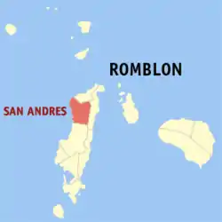
| Lage von San Andres in der Provinz Romblon | |||
|---|---|---|---|
 | |||
| Basisdaten | |||
| Region: | MIMAROPA | ||
| Provinz: | Romblon | ||
| Barangays: | 13 | ||
| PSGC: | 175912000 | ||
| Einkommensklasse: | 5. Einkommensklasse | ||
| Haushalte: | Zensus 1. Mai 2000 | ||
| Einwohnerzahl: | 15.589 Zensus 1. August 2015 | ||
| Bevölkerungsdichte: | 139,2 Einwohner je km² | ||
| Fläche: | 112,00 km² | ||
| Koordinaten: | 12° 31′ N, 122° 1′ O | ||
| Postleitzahl: | 5504 | ||
| Geographische Lage auf den Philippinen | |||
| |||

San Andres liegt im Nordwesten der Insel Tablas, an der Küste der Sibuyan-See. Die Topographie der Gemeinde wird durch flachwelliges Terrain gekennzeichnet. Ihre Nachbargemeinden sind Calatrava im Norden, Odiongan im Süden, San Agustin im Osten.
Baranggays
Die Gemeinde setzte sich 2011 aus 13 Barangays zusammen:
|
|
This article is issued from Wikipedia. The text is licensed under Creative Commons - Attribution - Sharealike. The authors of the article are listed here. Additional terms may apply for the media files, click on images to show image meta data.