Sétif (Provinz)
Die Provinz Sétif (arabisch ولاية سطيف, DMG Wilāyat Saṭīf, Zentralatlas-Tamazight ⴰⴳⴻⵣⴷⵓ ⵏ ⵙⵟⵉⴼ Agezdu n Sṭif) ist eine Provinz (wilaya) im nordöstlichen Algerien.
| Sétif | |
|---|---|
 Lage | |
| Basisdaten | |
| Staat | Algerien |
| Hauptstadt | Sétif |
| Fläche | 6526 km² |
| Einwohner | 1.505.000 (Schätzung 2006) |
| Dichte | 231 Einwohner pro km² |
| ISO 3166-2 | DZ-19 |
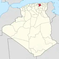
Die Provinz liegt rund 300 km östlich der Hauptstadt Algier auf einer landwirtschaftlich genutzten Hochebene auf 1100 m über NN, zwischen der Kabylei und dem Atlasgebirge. Die Fläche der Provinz beträgt 6526 km².
Rund 1.505.000 Einwohnern (Schätzung 2006) bewohnen die Provinz, die Bevölkerungsdichte beträgt somit rund 231 Einwohner/Quadratkilometer.
Hauptort und Verwaltungssitz ist die mittlere Universitätsstadt Sétif, von den insgesamt 60 Kommunen hat daneben noch die Stadt El Eulma mehr als 100.000 Einwohner.
Literatur
- Teddy Alzieu: „De Bougie à Sétif : à travers la Kabylie“. A. Sutton, Saint-Cyr-sur-Loire 2004. 128 S. ISBN 2-84910-148-6
- Said Madan¯i, Jordi Surinach: „Intermediate cities and sustainable development: the case of Setif – Algeria“. Urban regions: governing interacting economic, housing, and transport systems, (2002), S. 183–193. Utrecht : Koninklijk Nederlands Aadrijkskundig Genootschap
- Abdelaziz Zitouni: „Contribution à l'étude de l'influence des brise-vent sur les facteurs climatiques et la production céréalière en Algérie : (région des hautes plaines de Sétif)“. Paris, Univ., Dissertation 1991. 188 Bl.
- E. Brossard: „Essai sur la constitution physique et géologique des regions méridionales de la subdivision de Sétif (Algérie)“. Paris, 1868
Weblinks
Adrar | Ain Defla | Ain Temouchent | Algier | Annaba | Batna | Bechar | Bejaia | Béni Abbès | Biskra | Blida | Bordj Badji Mokhtar | Bordj Bou Arreridj | Bouira | Boumerdes | Chlef | Constantine | Djanet | Djelfa | El Bayadh | El Meniaa | El M'Ghair | El Oued | El Tarf | Ghardaia | Guelma | Illizi | In Guezzam | In Salah | Jijel | Khenchela | Laghouat | Medea | Mila | Mostaganem | M'Sila | Muaskar | Naama | Oran | Ouargla | Ouled Djellal | Relizane | Saida | Sétif | Sidi Bel Abbès | Skikda | Souk Ahras | Tamanrasset | Tebessa | Tiaret | Timimoun | Tindūf | Tipasa | Tissemsilt | Tizi Ouzou | Tlemcen | Touggourt | Umm al-Bawāqī