Rivière-du-Loup (regionale Grafschaftsgemeinde)
Rivière-du-Loup ist eine regionale Grafschaftsgemeinde (französisch municipalité régionale du comté, MRC) in der kanadischen Provinz Québec.
| Municipalité régionale de comté Rivière-du-Loup | |
|---|---|
| Staat | Kanada |
| Provinz | Québec |
| Verwaltungsregion | Bas-Saint-Laurent |
| Hauptort | Rivière-du-Loup |
| Einwohner | 33.958 (2016)[1] |
| Fläche | 1.277,15 km² |
| Bevölkerungsdichte | 26,6 Einw./km² |
| Gründung | 1. Januar 1982 |
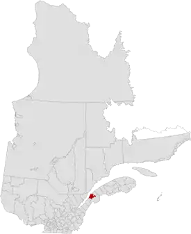 | |
Sie liegt in der Verwaltungsregion Bas-Saint-Laurent und besteht aus 13 untergeordneten Verwaltungseinheiten (eine Stadt, acht Gemeinden und vier Sprengel). Die MRC wurde am 1. Januar 1982 gegründet.[2] Der Hauptort ist Rivière-du-Loup. Die Einwohnerzahl beträgt 33.958 (Stand: 2016) und die Fläche 1.277,15 km², was einer Bevölkerungsdichte von 26,6 Einwohnern je km² entspricht.
Gliederung
Stadt (ville)
Gemeinde (municipalité)
- Cacouna
- L'Isle-Verte
- Notre-Dame-du-Portage
- Saint-Cyprien
- Saint-Épiphane
- Saint-François-Xavier-de-Viger
- Saint-Hubert-de-Rivière-du-Loup
- Saint-Modeste
Sprengel (municipalité de paroisse)
- Notre-Dame-des-Sept-Douleurs
- Saint-Antonin
- Saint-Arsène
- Saint-Paul-de-la-Croix
Auf dem Gebiet der MRC Rivière-du-Loup liegt auch das Indianerreservat Whitworth, das jedoch autonom verwaltet wird und eine Enklave bildet.
Weblinks
Commons: Rivière-du-Loup (regionale Grafschaftsgemeinde) – Sammlung von Bildern, Videos und Audiodateien
- Offizielle Website
- Statistische Daten (Memento vom 2. Mai 2012 im Internet Archive)
Einzelnachweise
This article is issued from Wikipedia. The text is licensed under Creative Commons - Attribution - Sharealike. The authors of the article are listed here. Additional terms may apply for the media files, click on images to show image meta data.