Parker Strip
Parker Strip ist ein Census-designated place im La Paz County im US-Bundesstaat Arizona. Parker Strip hat 3302 Einwohner auf einer Fläche von 21,8 km². Das Dorf liegt direkt am Colorado River, der die Grenze zwischen Arizona und Kalifornien bildet. Parker Strip wird von der Arizona State Route 95 tangiert und ist vom Buckskin Mountain State Park umschlossen.
| Parker Strip | |
|---|---|
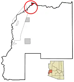 Lage im County und in Arizona | |
| Basisdaten | |
| Staat: | Vereinigte Staaten |
| Bundesstaat: | Arizona |
| County: | La Paz County |
| Koordinaten: | 34° 14′ N, 114° 11′ W |
| Zeitzone: | Mountain Standard Time (UTC−7) |
| Einwohner: | 621 (Stand: 2020) |
| Fläche: | 21,8 km² (ca. 8 mi²) davon 18,4 km² (ca. 7 mi²) Land |
| FIPS: | 04-53210 |
| GNIS-ID: | 2409030 |
This article is issued from Wikipedia. The text is licensed under Creative Commons - Attribution - Sharealike. The authors of the article are listed here. Additional terms may apply for the media files, click on images to show image meta data.