Cibola (Arizona)
Cibola ist ein Census-designated place im La Paz County im US-Bundesstaat Arizona. Cibola hat 176 Einwohner auf einer Fläche von 46,6 km². Die Bevölkerungsdichte liegt bei 3,7 Einwohner / km². Cibola liegt nahe dem Colorado River nahe der Grenze zum US-Bundesstaat Kalifornien.
| Cibola | |
|---|---|
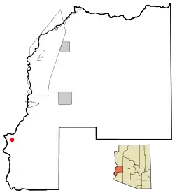 Lage in Arizona | |
| Basisdaten | |
| Staat: | Vereinigte Staaten |
| Bundesstaat: | Arizona |
| County: | La Paz County |
| Koordinaten: | 33° 22′ N, 114° 40′ W |
| Zeitzone: | Mountain Standard Time (UTC−7) |
| Einwohner: | 198 (Stand: 2020) |
| Fläche: | 46,7 km² (ca. 18 mi²) davon 46,6 km² (ca. 18 mi²) Land |
| Höhe: | 74 m |
| Postleitzahl: | 85328 |
| Vorwahl: | +1 928 |
| FIPS: | 04-13470 |
| GNIS-ID: | 0024371 |
This article is issued from Wikipedia. The text is licensed under Creative Commons - Attribution - Sharealike. The authors of the article are listed here. Additional terms may apply for the media files, click on images to show image meta data.