Padre Garcia
Padre Garcia (Tagalog: Bayan ng Padre Garcia) ist eine philippinische Stadtgemeinde in der Provinz Batangas, in der Verwaltungsregion IV, Calabarzon. Sie hat 48.302 Einwohner (Zensus 1. August 2015), die in 33 Barangays lebten. Sie wird als Gemeinde der zweiten Einkommensklasse auf den Philippinen und als urbanisiert eingestuft.
| Municipality of Padre Garcia | |||
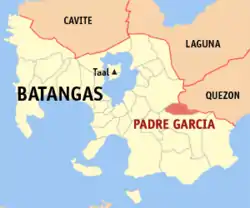
| Lage von Padre Garcia in der Provinz Batangas | |||
|---|---|---|---|
 | |||
| Basisdaten | |||
| Region: | CALABARZON | ||
| Provinz: | Batangas | ||
| Barangays: | 33 | ||
| Distrikt: | 4. Distrikt von Batangas | ||
| PSGC: | 041020000 | ||
| Einkommensklasse: | 2. Einkommensklasse | ||
| Haushalte: | Zensus 1. Mai 2000 | ||
| Einwohnerzahl: | 48.302 Zensus 1. August 2015 | ||
| Bevölkerungsdichte: | 1164 Einwohner je km² | ||
| Fläche: | 41,51 km² | ||
| Koordinaten: | 13° 53′ N, 121° 13′ O | ||
| Postleitzahl: | 4224 | ||
| Geographische Lage auf den Philippinen | |||
| |||

Die Topographie der Gemeinde ist gekennzeichnet durch gebirgiges Terrain. Ihre Nachbargemeinden sind San Antonio, Provinz Quezon, im Nordosten, Lipa City im Norden, Rosario im Süden und Westen.
Baranggays
|
|
|
This article is issued from Wikipedia. The text is licensed under Creative Commons - Attribution - Sharealike. The authors of the article are listed here. Additional terms may apply for the media files, click on images to show image meta data.