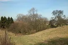
Liste der Landschaftsschutzgebiete in Mülheim an der Ruhr
Die Liste der Landschaftsschutzgebiete in Mülheim an der Ruhr enthält die Landschaftsschutzgebiete der kreisfreien Stadt Mülheim an der Ruhr in Nordrhein-Westfalen.
Liste
| Bild | Nummer | Bezeichnung des Gebietes | Fläche in Hektar | WDPA-ID | Koordinaten | Datum der Verordnung |
|---|---|---|---|---|---|---|
 |
LSG-4506-0023 | LSG Speldorf–Styrumer Ruhraue | 218,0364 | 555554319 | Position | 1982 |
| LSG-4506-0024 | LSG Wald zwischen Wolfsburg und Uhlenhorstweg | 104,1478 | 555554320 | Position | 1982 | |
_Heuken.jpg.webp) |
LSG-4506-0046 | LSG Nachtigallental und Scheuerbachtal | 20,2522 | 555554321 | Position | 2005 |
| LSG-4506-0048 | LSG Broich-Speldorfer Wald und Lintorfer Mark | 901,4753 | 555554322 | Position | 1982 | |
| LSG-4506-0049 | LSG Deponieerweiterungsfläche Kolkerhofweg <temporär> | 21,1967 | 555554323 | Position | 2005 | |
 |
LSG-4507-0006 | LSG Hauptfriedhof Anmerkung: dieses LSG umfasst große Teile des Hauptfriedhofs |
45,4986 | 555554330 | Position | 1982 |
| LSG-4507-0007 | LSG Bühlsbachtal und Schengerholzbach | 56,5927 | 555554331 | Position | 1982 | |
 |
LSG-4507-0008 | LSG Witthausbusch | 53,6216 | 555554332 | Position | 1982 |
 |
LSG-4507-0009 | LSG Oppspring und Rumbachtal | 295,5605 | 555554333 | Position | 1982 |
| LSG-4507-0045 | LSG Friedhof am Herderweg | 22,0345 | 555554334 | Position | 2005 | |
| LSG-4507-0046 | LSG Hexbachtal und Winkhauser Bachtäler | 207,5629 | 555554335 | Position | 2005 | |
| LSG-4507-0047 | LSG Mühlenbach–Frohnhauser Weg | 15,531 | 555554336 | Position | 2005 | |
| LSG-4507-0048 | LSG Horbachtal | 17,6033 | 555554337 | Position | 2005 | |
| LSG-4507-0049 | LSG Friedhof am Heubach | 9,7149 | 555554338 | Position | 2005 | |
| LSG-4507-0050 | LSG Ruhraue zwischen Menden und Konrad-Adenauer-Brücke | 54,5171 | 555554339 | Position | 2005 | |
_Feld_N.jpg.webp) |
LSG-4507-0051 | LSG Park und Alter Friedhof an der Straße Lohscheidt | 10,5121 | 555554340 | Position | 2005 |
 |
LSG-4507-0052 | LSG Hauptfriedhof Anmerkung: dieses LSG umfasst Flächen außerhalb des Hauptfriedhofs |
506,6561 | 555554341 | Position | 1982 |
 |
LSG-4606-0027 | LSG Naherholungsgebiet Entenfang | 34,112 | 555554639 | Position | 2005 |
| LSG-4606-0028 | LSG Golfplatz am Haubach | 109,8984 | 555554640 | Position | 2005 | |
 |
LSG-4607-0015 | LSG Saarn–Selbecker Hochflächen | 372,285 | 555554659 | Position | 1982 |
 |
LSG-4607-0016 | LSG Ruhraue zwischen Menden und Mintard | 345,6395 | 555554660 | Position | 1982 |
Weblinks
Commons: Landschaftsschutzgebiete in Mülheim an der Ruhr – Sammlung von Bildern, Videos und Audiodateien
This article is issued from Wikipedia. The text is licensed under Creative Commons - Attribution - Sharealike. The authors of the article are listed here. Additional terms may apply for the media files, click on images to show image meta data.