Liste der Landschaftsschutzgebiete im Kreis Wesel
Die Liste der Landschaftsschutzgebiete im Kreis Wesel enthält die Landschaftsschutzgebiete des Kreises Wesel in Nordrhein-Westfalen.
Liste
| Bild | Nummer | Bezeichnung des Gebietes | Fläche in Hektar | WDPA-ID | Koordinaten | Datum der Verordnung |
|---|---|---|---|---|---|---|
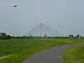
| LSG-4204-0001 | LSG Seenlandschaft bei Bislich | 993,6616 | 555553581 | Position | 2009 | |
| LSG-4405-145 | LSG Saalhofer Ley | 70,217 | Position | 1991 | ||
| LSG-4405-146 | LSG Hörstgenshof, Elmendorf, Geilingshof | 15,082 | Position | 1991 | ||
| LSG-4405-147 | LSG Nördlich von Alpsray | 3,2564 | Position | 1991 | ||
| LSG-4405-148 | LSG Südliche Heidecker Ley | 4,3368 | Position | 1991 | ||
| LSG-4405-157 | LSG Dachsberg | 29,1035 | Position | 1991 | ||
| LSG-4405-158 | LSG Issumer Fleuth, südlich von Kamperbrück | 45,509 | Position | 1991 | ||
| LSG-4405-159 | LSG Waldgebiet südlich des Hohen Busches | 26,7133 | Position | 1991 | ||
| LSG-4405-160 | LSG Am Kloster Kamp | 4,7946 | Position | 1991 | ||
| LSG-4405-161 | LSG Hoher Busch | 62,1104 | Position | 1991 | ||
| LSG-4404-156 | LSG Fossa Eugeniana, nördlich Dachsberg | 4,6873 | Position | 1991 | ||
_-_LSG_M%C3%BChlohlsley_02.jpg.webp) weitere Bilder |
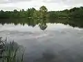
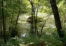
LSG-4405-0001 | LSG Mühlohlsley | 52,1317 | 555554006 | Position | 2009 |
| LSG-4405-0002 | LSG Gathsche Ley, Kolk bei Borth, Achterste Weide | 55,1455 | 555691048 | Position | 2009 | |
 weitere Bilder |
LSG-4405-0003 | LSG Waldfläche bei Damm | 56,8715 | 555554008 | Position | 2009 |
| LSG-4405-0004 | LSG Alpsche Ley | 26,1739 | 555554009 | Position | 2009 | |
| LSG-4405-0005 | LSG Drüptsche Ley, Rheinberger Ley | 62,7757 | 555554010 | Position | 2009 | |
| LSG-4405-0006 | LSG Niederung bei Alpsray, Heidecker Ley, Fossa Eugeniana | 48,8175 | 555638521 | Position | 2009 | |
 weitere Bilder |
LSG-4405-0007 | LSG Rheinvorland an der Momm und Rheinauenwald | 106,0707 | 555554012 | Position | 2009 |
| LSG-4405-0008 | LSG Baggersee bei Millingen und Wald-Offenlandkomplex am Loisberg | 48,0319 | 555554013 | Position | 2009 | |
| LSG-4405-0009 | LSG Rheinberger Heide | 135,8184 | 555554014 | Position | 2009 | |
| LSG-4405-0010 | LSG Orsoyer Rheinbogen und Eversael | 438,4879 | 555554015 | Position | 2009 | |
| LSG-4405-0011 | LSG Moersbach, Winterswicker Abzugsgraben, Niepgraben, Grintgraben | 273,9824 | 555554016 | Position | 2009 | |
| LSG-4405-0012 | LSG Haus Wolfskuhlen und Baggerseen südlich Budberg | 223,9653 | 555554017 | Position | 2009 | |
| LSG-4405-0013 | LSG Spanische Schanzen, Peldenhof und Baggerseen östlich Budberg | 64,7803 | 555554018 | Position | 2009 | |
| LSG-4405-0014 | LSG Haferbruchsee | 96,7292 | 555554019 | Position | 2009 | |
| LSG-4405-144 | LSG Nördliche Heidecker Ley | 26,6643 | Position | 1991 | ||
| LSG-4405-162 | LSG Niersenberg | 19,0842 | Position | 1991 | ||
| LSG-4405-163 | LSG Fossa Eugeniana an der Rheinberger Straße | 12,1095 | Position | 1991 | ||
| LSG-4405-164 | LSG Laukenshof | 7,1025 | Position | 1991 | ||
| LSG-4405-165 | LSG Nördlich Vogelsangberg | 18,3938 | Position | 1991 | ||
| LSG-4405-166 | LSG Rossenrayer Feld | 129,8009 | Position | 1991 | ||
| LSG-4405-168 | LSG Fossa Eugeniana, Eyllsche Kendel, Haus Eyll, Littardsche Kendel | 18,0122 | Position | 1991 | ||
| LSG-4405-180 | LSG Impler Berg | 11,5694 | 555561050 | Position | 1991 | |
 weitere Bilder |
LSG-4405-181 | LSG Halde Pattberg | 41,3967 | 555561051 | Position | 1991 |
| LSG-4405-182 | LSG Rheinkamper Feld | 65,2938 | Position | 1991 | ||
| LSG-4405-183 | LSG Rheinkamper Moersbachaue und Lohkanal | 67,3876 | Position | 1991 | ||
 Anrathskanal |
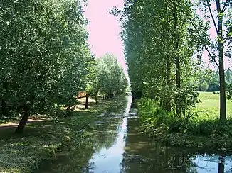
LSG-4405-185 | LSG Anrathskanal | 103,7676 | Position | 1991 | |
| LSG-4406-0004 | LSG Rheinvorland bei Orsoy | 25,3578 | 555554046 | Position | 2009 | |
| LSG-4406-0005 | LSG Lohkanal, Orsoyer Berg, Ohlmannshof | 55,2692 | 555554047 | Position | 2009 | |
| LSG-4406-0006 | LSG Im Bruch – südlich entlang des Lohberger Entwässerungsgrabens | 5,1516 | 555554048 | Position | 2009 | |
 |
LSG-4406-0007 | LSG Oberlohberg | 239,9392 | 555554049 | Position | 2009 |
| LSG-4406-0008 | LSG Wehofer-, Hiesfelderbruch, Hühnerheide und Landgraben | 176,736 | 555554050 | Position | 2009 | |
| LSG-4204-0002 | LSG Hagener Meer/Galgenberg | 104,6499 | 555553582 | Position | 2004 | |
| LSG-4204-0008 | LSG Wolfstrang | 408,9138 | 555553588 | Position | 2004 | |
| LSG-4204-0015 | LSG Husen | 60,7334 | 555553593 | Position | 2004 | |
| LSG-4204-0016 | LSG Grünlandniederung Gesthuysen und Vynsche Ley | 33,307 | 555553594 | Position | 2004 | |
| LSG-4204-0017 | LSG Niederung Hohe Ley und Heckgraben | 139,3368 | 555553595 | Position | 2004 | |
| LSG-4205-0001 | LSG Werther Bruch | 629,4388 | 555553596 | Position | 2004 | |
| LSG-4205-0002 | LSG Randbereiche des Diersfordter Waldes und Wittenhorster Graben | 829,3058 | 555553597 | Position | 2009 | |
| LSG-4205-0003 | LSG Isselniederung | 1586,9108 | 555553598 | Position | 2004 | |
| LSG-4205-0004 | LSG Risswald/Bislicher Wald | 192,1261 | 555553599 | Position | 2004 | |
| LSG-4205-0005 | LSG Leitgraben | 387,718 | 555553600 | Position | 2004 | |
| LSG-4205-0006 | LSG Dingender und Brüner Höhen | 1992,7287 | 555553601 | Position | 2004 | |
| LSG-4205-0007 | LSG Isselniederung, Drevenacker Landwehr | 753,1005 | 555553602 | Position | 2009 | |
| LSG-4206-0001 | LSG Stammshutte | 315,7285 | 555553603 | Position | 2004 | |
| LSG-4206-0002 | LSG Issel | 199,1075 | 555553604 | Position | 2004 | |
| LSG-4206-0003 | LSG Brünen Ost | 1568,8236 | 555553605 | Position | 2004 | |
| LSG-4206-0004 | LSG Forstrevier Steinberge | 339,4481 | 555553606 | Position | 2004 | |
| LSG-4207-0001 | LSG Forst Gewerkschaft Augustus | 820,4387 | 555553611 | Position | 2004 | |
| LSG-4404-0004 | LSG Winkelscher Busch und Brandhorst | 230,6379 | 555553991 | Position | 2004 | |
| LSG-4404-0005 | LSG Kapellsche Bruch/Hamber Bruch | 243,4766 | 555553992 | Position | 2004 | |
| LSG-4404-0006 | LSG Helmes Ley | 10,0859 | 555553993 | Position | 2004 | |
| LSG-4404-0009 | LSG Bönninghardt, Haagscher Berg, Passberg | 607,5018 | 555553994 | Position | 2009 | |
| LSG-4404-0010 | LSG Ehemalige Bahndämme nördlich von Alpen und Menzelen | 44,1725 | 555553995 | Position | 2009 | |
| LSG-4404-0011 | LSG Höhenrand der Bönninghardt und der Leucht | 123,2533 | 555553996 | Position | 2009 | |
| LSG-4404-142 | LSG nordwestlich der Leucht | 133,6382 | Position | 1991 | ||
.jpg.webp) weitere Bilder |
LSG-4404-143 | LSG Die Leucht | 1065,2964 | 555561039 | Position | 1991 |
| LSG-4404-149 | LSG Nenneper Fleuth mit Haus Frohnenbruch, Kolkmannsfeld, Frohnenbroicher Heide u. nördl. Hoerstgener Kendel | 88,9585 | Position | 1991 | ||
 |
LSG-4404-150 | LSG Issumer Fleuth und Mönchschall | 81,6183 | Position | 1991 | |
| LSG-4404-152 | LSG Bärlag | 100,0139 | 555561040 | Position | 1991 | |
| LSG-4404-153 | LSG Hoerstgener Kendel, nördlich der Hoerstgener Straße | 15,8672 | 555561041 | Position | 1991 | |
| LSG-4404-154 | LSG Hoerstgener Kendel, südlich der Hoerstgener Straße | 76,6571 | Position | 1991 | ||
 weitere Bilder |
LSG-4404-155 | LSG Noppicker Feld, Spanische Schanze | 37,4178 | 555589489 | Position | 1991 |
 |
LSG-4305-0004 | LSG Schwarzer Graben, Borthsche Ley | 481,1073 | 555553793 | Position | 2009 |
| LSG-4305-0005 | LSG Elverische Höfe | 23,1782 | 555553794 | Position | 2009 | |
| LSG-4305-0006 | LSG Spellener Dünen | 9,1502 | 555553795 | Position | 2009 | |
| LSG-4305-0007 | LSG Ork, Spellen, Unteremelsum, Mehr, Löhnen, Mehrum, Götterswickerhamm, Haus Ahr und | 841,4928 | 555553796 | Position | 2009 | |
| LSG-4305-0008 | LSG Auesee | 187,4146 | 555553797 | Position | 2009 | |
| LSG-4305-0009 | LSG Flürener Heide | 157,345 | 555553798 | Position | 2009 | |
| LSG-4305-0010 | LSG Poll, Ginderichswardt | 224,9896 | 555553799 | Position | 2009 | |
 weitere Bilder |
LSG-4305-0011 | LSG Alt-Büderich, Zur Bauerschaft und ehemalige Bahntrasse | 105,8228 | 555553800 | Position | 2009 |
| LSG-4305-0012 | LSG Rheinvorland östlich Büderich | 16,8362 | 555553801 | Position | 2009 | |
 |
LSG-4305-0013 | LSG Wackenbruch, Krudenburger Wald, Aaper Busch, Randbereiche der Lippeaue | 410,4991 | 555553802 | Position | 2009 |
| LSG-4305-0014 | LSG Wesel-Datteln-Kanal, Lippedorf | 164,5048 | 555553803 | Position | 2009 | |
| LSG-4305-0020 | LSG Der Huck | 26,6885 | 555553804 | Position | 2009 | |
| LSG-4306-0002 | LSG Holthauser und Speller Heide | 139,6279 | 555553805 | Position | 2009 | |
| LSG-4306-0003 | LSG Issel | 438,9063 | 555553806 | Position | 2004 | |
 |
LSG-4306-0004 | LSG Sträterei, Grafschaft, Lingelmannstraße | 715,7098 | 555553807 | Position | 2009 |
| LSG-4306-0006 | LSG Westlich Schermbeck | 4205,3356 | 555553808 | Position | 2004 | |
| LSG-4306-0007 | LSG Waldkomplexe bei Drevenack | 304,662 | 555553809 | Position | 2004 | |
| LSG-4306-0008 | LSG Lippeaue | 666,2774 | 555553810 | Position | 1974 | |
| LSG-4306-0009 | LSG Bruckhauser/Bucholtwelmener Ebene | 1150,4153 | 555553811 | Position | 2004 | |
| LSG-4306-0010 | LSG Hauptterrasse südlich Hünxe | 3336,1179 | 555553812 | Position | 2004 | |
| LSG-4306-0011 | LSG Möllen und Wohnungswald | 337,2253 | 555553813 | Position | 2009 | |
| LSG-4306-0012 | LSG Egerheide, Schlägersheide und Schlägerhardt | 507,8836 | 555553814 | Position | 2009 | |
| LSG-4307-0004 | LSG Schermbeck-Ost | 123,992 | 555553818 | Position | 2004 | |
| LSG-4307-0006 | LSG Brackenberg | 32,5237 | 555553820 | Position | 2004 | |
| LSG-4307-0007 | LSG Südlich Gahlen | 380,2541 | 555553821 | Position | 2004 | |
| LSG-4303-0001 | LSG Veen-Sonsbecker-Bruch | 456,2283 | 555553756 | Position | 2004 | |
| LSG-4304-0001 | LSG Steinchensbusch | 24,7041 | 555553766 | Position | 2004 | |
| LSG-4304-0002 | LSG Niederung Körvesley/Marienbaumergraben | 27,7034 | 555553767 | Position | 2004 | |
| LSG-4304-0003 | LSG Niederung Pistley | 47,8159 | 555553768 | Position | 2004 | |
| LSG-4304-0004 | LSG Leybach-System | 405,6164 | 555553769 | Position | 2004 | |
| LSG-4304-0005 | LSG Stadtveen | 243,4614 | 555553770 | Position | 2004 | |
 weitere Bilder |
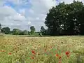
LSG-4304-0006 | LSG Sonsbecker Schweiz | 506,9867 | 555553771 | Position | 2004 |
| LSG-4304-0007 | LSG Südlicher Taschenwald | 177,7939 | 555553772 | Position | 2004 | |
| LSG-4304-0008 | LSG Hufscher Berg/Löwenberg | 261,1064 | 555553773 | Position | 2004 | |
| LSG-4304-0009 | LSG Clossenwoy | 7,0005 | 555553774 | Position | 2004 | |
| LSG-4304-0010 | LSG Eichenwald am Grenzdyck | 3,9309 | 555553775 | Position | 2009 | |
| LSG-4304-0012 | LSG Marwick, Loh, Mars, Harsumer Graben, Schlossanlage Diersfordt | 211,0267 | 555553776 | Position | 2009 | |
| LSG-4304-0022 | LSG Veensche Ley, Veener Ley und Veen-Winnenthaler Ley | 94,3427 | 555553777 | Position | 2009 | |
| LSG-4304-0023 | LSG Südlich Passenstraße und Veendyk | 186,2992 | 555553778 | Position | 2009 | |
| LSG-4304-0024 | LSG Birkenkampsley, Hockenderley, Winnenthaler Kanal | 240,8302 | 555553779 | Position | 2009 | |
| LSG-4304-0027 | LSG Tannenspeet/Großenbusch | 124,9697 | 555553780 | Position | 2004 | |
| LSG-4304-0028 | LSG Boxteler Bahn zwischen Gemeindegrenze Uedem und Xanten/Trajanstraße | 11,2746 | 555553781 | Position | 2004 | |
 weitere Bilder |
LSG-4304-0031 | LSG Bislicher Insel | 134,1043 | 555553782 | Position | 2004 |
| LSG-4304-0032 | LSG Landwehren südlich der Weseler Straße | 21,5017 | 555553783 | Position | 2004 | |
| LSG-4304-0033 | LSG Parkanlage Burg Winnenthal und Winnenthaler Kanal | 56,8372 | 555553784 | Position | 2004 | |
| LSG-4304-0034 | LSG Offenland zwischen der Hees und Fürstenberg | 337,4562 | 555553785 | Position | 2004 | |
 weitere Bilder |
LSG-4304-0035 | LSG Die Hees | 251,767 | 555553786 | Position | 2004 |
| LSG-4304-0036 | LSG Latzenbusch | 60,781 | 555553787 | Position | 2004 | |
| LSG-4304-0040 | LSG Niederungen südlich und östlich Grenzdyck | 216,9851 | 555553788 | Position | 2004 | |
| LSG-4304-013 | LSG Feldgehölze bei Willich | 2,2924 | Position | 1982 | ||
| LSG-4305-0001 | LSG Elverische Höfe | 11,0674 | 555553790 | Position | 2009 | |
| LSG-4305-0002 | LSG Leygraben | 51,1681 | 555553791 | Position | 2009 | |
| LSG-4305-0003 | LSG Menzeler Heide | 17,7828 | 555553792 | Position | 2009 | |
| LSG-4504-167 | LSG Damm an der ehemaligen Bahnlinie und angrenzende Feldgehölze westlich und südlich der B 510 | 28,3081 | Position | 1991 | ||
| LSG-4505-0003 | LSG Bettenkamp | 19,6571 | Position | 1973 | ||
| LSG-4505-0004 | LSG Eicker Wiesen | 22,1841 | Position | 1973 | ||
| LSG-4505-0006 | LSG Niephauser Feld | 14,4555 | Position | 1973 | ||
 |
LSG-4505-040 | LSG Littardsche Kendel, Eylische Kendel und Schloss Bloemersheim | 18,2071 | Position | 1991 | |
| LSG-4505-169 | LSG Waldbestand nördlich der Motocross-Rennbahn | 5,1574 | Position | 1991 | ||
| LSG-4505-170 | LSG Ehemalige Bahntrasse am Eyller Berg | 9,2639 | 555561190 | Position | 1991 | |
| LSG-4505-171 | LSG Eyller Berg | 41,1951 | 555561191 | Position | 1991 | |
| LSG-4505-172 | LSG Kleine Goorley, südlich Parsickgraben, Anrathskanal | 47,2744 | Position | 1991 | ||
| LSG-4505-173 | LSG Spörkmanns Veen | 3,4763 | Position | 1991 | ||
| LSG-4505-174 | LSG Vinnmannshof westlich der Norddeutschlandstraße | 7,973 | Position | 1991 | ||
| LSG-4505-175 | LSG Waldbestand nördlich und südlich der Rayer Straße | 40,3459 | Position | 1991 | ||
| LSG-4505-176 | LSG Vinnbruchgraben und ehemaliger Bahndamm im Niephauser Feld | 31,9005 | Position | 1991 | ||
| LSG-4505-177 | LSG Am Landwehrgraben nördlich Haarbeckstraße | 15,7176 | Position | 1991 | ||
| LSG-4505-178 | LSG Anrathskanal südlich der Rayer Straße | 24,8461 | Position | 1991 | ||
| LSG-4505-184 | LSG Repelener Moersbach-Durchstich | 10,2622 | Position | 1991 | ||
| LSG-4505-186 | LSG Genender Bahndamm | 11,1911 | Position | 1991 | ||
| LSG-4505-187 | LSG Balderbruchgraben | 107,7519 | Position | 1991 | ||
| LSG-4505-188 | LSG Hülsdonker Büschchen | 9,079 | 555561196 | Position | 1991 | |
| LSG-4505-189 | LSG Wiesfurthgraben und Dong | 155,6335 | Position | 1991 | ||
| LSG-4505-190 | LSG Abgrabung Mühlenfeld | 29,1937 | 555561197 | Position | 1991 | |
weitere Bilder |
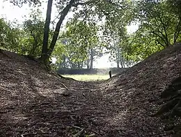
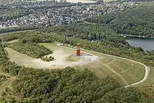
LSG-4505-191 | LSG Halde Norddeutschland | 94,5603 | 555561198 | Position | 1991 |
| LSG-4505-192 | LSG Plankendickskendel, Hochkamer Landwehr und Köhrrahmsley | 157,1789 | Position | 1991 | ||
| LSG-4505-193 | LSG Schwanenbrückskendel und Gülixberg | 32,8769 | Position | 1991 | ||
| LSG-4505-194 | LSG Vluynbusch | 248,9182 | Position | 1991 | ||
| LSG-4505-196 | LSG Köhrrahmsley | 26,4904 | Position | 1991 | ||
| LSG-4505-197 | LSG Spickerbruch | 25,8837 | Position | 1991 | ||
| LSG-4505-198 | LSG Neufelder Straße | 10,1836 | Position | 1991 | ||
| LSG-4505-200 | LSG Donke Hasselt | 95,0676 | Position | 1991 | ||
| LSG-4505-201 | LSG Am Hesselfeld | 67,4996 | Position | 1991 | ||
| LSG-4505-202 | LSG Klingerhuf | 32,9563 | 555561202 | Position | 1991 | |
| LSG-4505-203 | LSG Neukirchener Kanal | 47,3603 | 555561203 | Position | 1991 | |
| LSG-4505-204 | LSG Am Paschbusch | 42,1173 | Position | 1991 | ||
| LSG-4505-205 | LSG Utforter Moersbachniederung | 86,382 | Position | 1991 | ||
 |
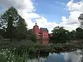
LSG-4505-206 | LSG Waldsee | 85,5411 | 555561204 | Position | 1991 |
 weitere Bilder |
LSG-4505-207 | LSG Halde Rheinpreußen | 51,1794 | 555561205 | Position | 1991 |
| LSG-4505-208 | LSG Gertbachniederung | 24,5696 | Position | 1991 | ||
| LSG-4505-209 | LSG Vinner Feld | 12,2878 | 555561207 | Position | 1991 | |
| LSG-4505-210 | LSG Süsselheide | 63,1326 | 555561208 | Position | 1991 | |
| LSG-4505-211 | LSG Ophülsgraben, Hagenscher Graben, Achterrathsheide | 172,2296 | 555561209 | Position | 1991 | |
| LSG-4505-212 | LSG Klietbruch | 107,3438 | 555561210 | Position | 1991 | |
| LSG-4505-214 | LSG Weimannsfeld, Stockrahmsfeld | 10,1253 | Position | 1991 | ||
| LSG-4505-215 | LSG Achterrathsheidegraben | 68,0508 | Position | 1991 | ||
| LSG-4505-216 | LSG Kapellener Moersbachniederung | 138,774 | Position | 1991 | ||
 weitere Bilder |
LSG-4505-217 | LSG Aubruchkanal und Schwafheimer Kendel | 68,5157 | Position | 1991 | |
 weitere Bilder |
LSG-4505-218 | LSG Lauersforter Wald | 140,7429 | 555561213 | Position | 1991 |
| LSG-4505-219 | LSG Vinngraben | 20,8179 | Position | 1991 | ||
 weitere Bilder |
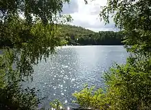
LSG-4505-220 | LSG Schwafheimer Seenplatte | 82,2305 | 555561214 | Position | 1991 |
| LSG-4505-222 | LSG See am Schwarzen Weg | 11,9724 | Position | 1991 | ||
| LSG-4506-221 | LSG Essenberger Bruchgraben | 3,1763 | 555561216 | Position | 1991 | |
| LSG-4605-213 | LSG Luiter Feld | 17,4219 | Position | 1991 |
Siehe auch
Weblinks
Naturschutzgebiete | Landschaftsschutzgebiete | geschützte Landschaftsbestandteile
Naturdenkmale: Naturdenkmale im Innenbereich des Kreises Wesel
Naturdenkmale in den Landschaftsplänen: Alpen/Rheinberg | Dinslaken/Voerde | Raum Hamminkeln | Hünxe/Schermbeck | Kamp-Lintfort/Moers/Neukirchen-Vluyn | Sonsbeck/Xanten | Wesel
Städteregion Aachen | Bielefeld | Bochum | Bonn | Borken | Bottrop | Coesfeld | Dortmund | Duisburg | Düren | Düsseldorf | Ennepe-Ruhr-Kreis | Essen | Euskirchen | Gelsenkirchen | Gütersloh | Hagen | Hamm | Heinsberg | Herford | Herne | Hochsauerlandkreis | Höxter | Kleve | Köln | Krefeld | Leverkusen | Lippe | Märkischer Kreis | Mettmann | Minden-Lübbecke | Mönchengladbach | Mülheim an der Ruhr | Münster | Oberbergischer Kreis | Oberhausen | Olpe | Paderborn | Recklinghausen | Remscheid | Rhein-Erft-Kreis | Rheinisch-Bergischer Kreis | Rhein-Kreis Neuss | Rhein-Sieg-Kreis | Siegen-Wittgenstein | Soest | Solingen | Steinfurt | Unna | Viersen | Warendorf | Wesel | Wuppertal