Hoosier Hill
Der Hoosier Hill ist mit seinen 383 Metern die höchste natürliche Erhebung des Wayne County und des amerikanischen US-Bundesstaates Indiana. Er befindet sich im Dearborn Upland, einem Hügelland im Osten Indianas. Im Jahre 2005 wurde eine Picknick-Stelle errichtet und der höchste Punkt wurde erstmals gekennzeichnet. Das Gebiet, auf welchem sich Hoosier Hill befindet, steht bis heute unter Privatbesitz.
| Hoosier Hill | ||
|---|---|---|
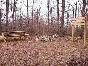
Die aufgeschütteten Steine symbolisieren den höchsten Punkt Indianas | ||
| Höhe | 383 m | |
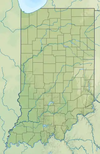
| Lage | Wayne County, Indiana, USA | |
| Gebirge | Dearborn Upland | |
| Dominanz | 75,06 km → Champaign County Prominence Point | |
| Schartenhöhe | 90 m ↓ Miami and Erie Canal | |
| Koordinaten | 40° 0′ 1″ N, 84° 51′ 3″ W | |
| ||
Weblinks
- Hoosier Hill auf Peakbagger.com (englisch)
- summitpost.org

Alabama | Alaska | Arizona | Arkansas | Colorado | Connecticut | Delaware | Florida | Georgia | Hawaii | Idaho | Illinois | Indiana | Iowa | Kalifornien | Kansas | Kentucky | Louisiana | Maine | Maryland | Massachusetts | Michigan | Minnesota | Mississippi | Missouri | Montana | Nebraska | Nevada | New Hampshire | New Jersey | New Mexico | New York | North Carolina | North Dakota | Ohio | Oklahoma | Oregon | Pennsylvania | Rhode Island | South Carolina | South Dakota | Tennessee | Texas | Utah | Vermont | Virginia | Washington | West Virginia | Wisconsin | Wyoming
Inselgebiete: Amerikanisch-Samoa | Guam | Minor Outlying Islands | Nördliche Marianen | Puerto Rico | Virgin Islands
Andere Gebiete: District of Columbia