Državna cesta D40
| Državna cesta D40 in Kroatien | |
 | |
| Karte | |
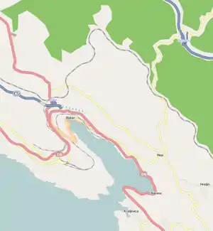 Verlauf der D 40 | |
| Basisdaten | |
| Betreiber: | Hrvatske ceste d.o.o. |
| Gesamtlänge: | 3,1 km |
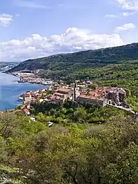 | |
| Bakar (Aufnahme 2008) | |
Verlauf
Die Državna cesta D40 (kroatisch für Nationalstraße D40) ist eine kurze Staatsstraße in Kroatien. Sie führt von der Anschlussstelle Sveti Kuzam der Autocesta A7 zum Hafen von Bakar.
Die Länge der Straße beträgt 3,1 km.
Literatur
- Freytag&Berndt Superatlas Kroatien, Slowenien, o. J., ISBN 978-3-7079-0423-9
- Jugoslavija, Prometna karta, Izdanje Jugoslavenskog Leksikografiskog Zavoda u Zagrebu, o. J.
This article is issued from Wikipedia. The text is licensed under Creative Commons - Attribution - Sharealike. The authors of the article are listed here. Additional terms may apply for the media files, click on images to show image meta data.