Chandannath
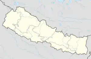
Chandannath (Nepali चन्दननाथ Chandannath) ist eine Stadt (Munizipalität) im Westen Nepals im Distrikt Jumla in der Provinz Karnali. Die Stadt ist Sitz der Distriktverwaltung.
| Chandannath Nagarpalika चन्दननाथ नगरपालिका Chandannath | |||
|---|---|---|---|
| |||
| Koordinaten | 29° 17′ N, 82° 12′ O | ||
| Basisdaten | |||
| Staat | Nepal | ||
| Karnali | |||
| Distrikt | Jumla | ||
| Höhe | 2350 m | ||
| Fläche | 102 km² | ||
| Einwohner | 19.047 (2011) | ||
| Dichte | 186,7 Ew./km² | ||
| Gründung | 18. Mai 2014 | ||
| 10 Wards[1] | |||
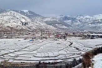 Blick auf Chandannath Blick auf Chandannath | |||
Geschichte
Die Stadt entstand 2014 durch Zusammenlegung der Village Development Committees Chandannath, Kartik Swami (mit dem Hauptort Jumla), Mahatgaun und Talium.[2][3]
Geographie
Chandannath liegt auf einer Höhe von 2350 m im Flusstal der Tila. Das Stadtgebiet umfasst 102 km².[4]
Einwohner
Bei der Volkszählung 2011 hatten die VDCs, aus welchen die Stadt Chandannath entstand, 19.047 Einwohner (davon 9369 männlich) in 3996 Haushalten.[5]
Verkehr
Chandannath verfügt über den kleinen Flugplatz Jumla. Die Fernstraße Karnali Rajmarg führt das Karnali- und Tila-Tal hinauf bis nach Chandannath.
Weblinks
Commons: Chandannath – Sammlung von Bildern, Videos und Audiodateien
Einzelnachweise
- Federal VDC Relation. In: UN Nepal Information Platform: Common Data Repository. Abgerufen am 1. Januar 2019 (englisch).
- 72 new municipalities announced. My Republica.com. Abgerufen am 10. Juni 2014.
- Government announces 72 new municipalities. The Kathmandu Post. Abgerufen am 10. Juni 2014.
- Municipal Association of Nepal (MuAN) (Memento des Originals vom 7. Januar 2014 im Internet Archive) Info: Der Archivlink wurde automatisch eingesetzt und noch nicht geprüft. Bitte prüfe Original- und Archivlink gemäß Anleitung und entferne dann diesen Hinweis.
- National Population and Housing Census 2011 (PDF) Central Bureau of Statistics. Archiviert vom Original am 31. Juli 2013.
This article is issued from Wikipedia. The text is licensed under Creative Commons - Attribution - Sharealike. The authors of the article are listed here. Additional terms may apply for the media files, click on images to show image meta data.