Arizona State Route 89
Die Arizona State Route 89 (kurz AZ 89) ist eine State Route im US-Bundesstaat Arizona, die in Nord-Süd-Richtung verläuft.

| |
|---|---|
| Basisdaten | |
| Gesamtlänge: | 105 mi / 168 km |
| Eröffnung: | 1993 |
| Anfangspunkt: | |
| Endpunkt: | |
| County: | Yavapai County |
| Wichtige Städte: | Prescott Chino Valley |
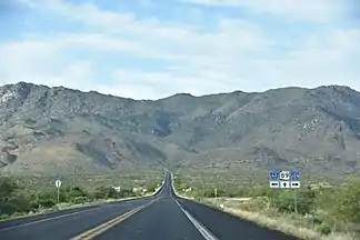
Arizona State Route 89 südlich der Weaver Mountains
Die State Route beginnt an der Interstate 40 nahe Ash Fork und endet nahe Wickenburg am U.S. Highway 93. Sie war früher ein Abschnitt des U.S. Highways 89. Ein anderer ehemalige Teil der US 89 zwischen Flagstaff und Prescott wurde zur Arizona State Route 89A herabgestuft. Die größte Stadt an der AZ 89 ist Prescott mit über 40.000 Einwohnern.
Weblinks
Commons: Arizona State Route 89 – Sammlung von Bildern, Videos und Audiodateien
- Arizona Roads (englisch)
- AARoads (englisch)
This article is issued from Wikipedia. The text is licensed under Creative Commons - Attribution - Sharealike. The authors of the article are listed here. Additional terms may apply for the media files, click on images to show image meta data.