Arizona State Route 71
Die Arizona State Route 71 (kurz AZ 71) ist eine State Route im US-Bundesstaat Arizona.

| |
|---|---|
| Karte | |
 | |
| Basisdaten | |
| Gesamtlänge: | 24 mi/39 km |
| Eröffnung: | 1936 |
| Anfangspunkt: | |
| Endpunkt: | |
| Countys: | Yavapai County Maricopa County |
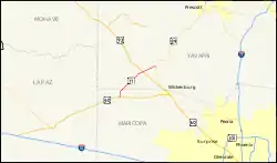
Die State Route beginnt an der Arizona State Route 89 nahe Congress und endet nahe Aguila am U.S. Highway 60. Nach etwa sieben Meilen trifft sie auf den U.S. Highway 93. Die Straße dient vor allem als Abkürzung zwischen Prescott und den bedeutenden Highways nach Kalifornien.
Weblinks
Commons: Arizona State Route 71 – Sammlung von Bildern, Videos und Audiodateien
This article is issued from Wikipedia. The text is licensed under Creative Commons - Attribution - Sharealike. The authors of the article are listed here. Additional terms may apply for the media files, click on images to show image meta data.