Antrim and Newtownabbey
Antrim and Newtownabbey (irisch Ceantar Aontroma agus Bhaile na Mainistreach) ist ein District in Nordirland. Er wurde am 1. April 2015 aus den beiden Boroughs Antrim und Newtownabbey gebildet. Verwaltet wird er durch das Antrim and Newtownabbey Borough Council.
| Antrim and Newtownabbey Irisch: Ceantar Aontroma agus Bhaile na Mainistreach Ulster Scots: Anthrim an Newtownabbey | |
|---|---|
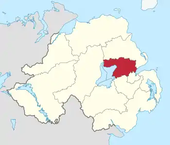 Lage von Antrim and Newtownabbey in Nordirland | |
| Basisdaten | |
| Staat | Vereinigtes Königreich |
| Landesteil | Nordirland |
| Distrikt | Antrim and Newtownabbey |
| Sitz | Antrim und Newtownabbey |
| Fläche | 572 km² |
| Einwohner | 140.500 (2015) |
| Dichte | 246 Einwohner pro km² |
| Gründung | 1. April 2015 |
| ISO 3166-2 | GB-ANN |
| Webauftritt | www.antrimandnewtownabbey.gov.uk (englisch) |
| Politik | |
| Mayor | John Scott |
| Partei | UUP |
Lage
Der District erstreckt sich über 710 km² vom Unterlauf des Bann und von Lough Neagh bis an die Küste des Belfast Lough. Dort leben etwa 138.000 Menschen,[1] wovon 93.762 wahlberechtigt sind.[2] Der Name des neuen Districts wurde am 17. September 2008 festgelegt.
Verwaltung
Das Antrim and Newtownabbey Borough Council ersetzte das Antrim Borough Council und das Newtownabbey Borough Council. Die ersten Wahlen für das District Council sollten eigentlich im Mai 2009 stattfinden, aber am 25. April 2008 verkündete Shaun Woodward, Minister für Nordirland, dass die Wahlen auf 2011 verschoben seien.[3] Die ersten Wahlen fanden dann tatsächlich am 22. Mai 2014 statt.
Einzelnachweise
- Antrim and Newtownabbey Borough Councils are merging in 2015.
- http://www.deac-ni.org/Homepage/deac_prov-recs.pdf (Link nicht abrufbar)
- Northern Ireland elections are postponed, BBC News (25. April 2008). Abgerufen am 6. Oktober 2015.