Albert J. Ellis Airport
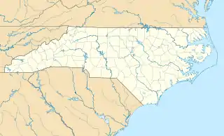
Albert J. Ellis Airport (IATA-Code OAJ, ICAO KOAJ) ist der öffentliche Flughafen etwa 16 Kilometer nordwestlich von Jacksonville im Onslow County in North Carolina, Vereinigte Staaten. Der Flughafen hat eine Start- und Landebahn und drei Flugsteige. Er wird weitgehend von Privatfliegern genutzt, jedoch auch von einigen kommerziellen Fluggesellschaften angeflogen.
| Albert J. Ellis Airport Jacksonville | |||
|---|---|---|---|
| |||
| Kenndaten | |||
| ICAO-Code | KOAJ | ||
| IATA-Code | OAJ | ||
| Koordinaten | |||
| Höhe über MSL | 29 m (95 ft) | ||
| Verkehrsanbindung | |||
| Entfernung vom Stadtzentrum | 16 km nordwestlich von Jacksonville | ||
| Straße | North Carolina State Route 111 | ||
| Basisdaten | |||
| Betreiber | Onslow County | ||
| Fläche | 273[1] ha | ||
| Passagiere | 313.000[2] (2018) | ||
| Flug- bewegungen | 37.653[1] (2016/17) | ||
| Beschäftigte | 2.785[3] (2018) | ||
| Start- und Landebahn | |||
| 05/23 | 2164 m × 46 m Asphalt | ||
Weblinks
- Offizielle Website des Flughafens (englisch)
- NCDOT Airport Information: Albert J. Ellis Airport (Memento vom 27. Februar 2008 im Internet Archive) (PDF; 278 kB, englisch)
Einzelnachweise
- AirportIQ 5010: Albert J. Ellis. GCR1.com, abgerufen am 14. Februar 2019 (englisch).
- New Airport Control Tower Invites Economic Development. FlyOAJ.com, 28. Januar 2019, abgerufen am 14. Februar 2019 (englisch).
- North Carolina: The State of Aviation. NCDoT.gov, 7. Januar 2019, abgerufen am 14. Februar 2019 (englisch).
Flughäfen im US-Bundesstaat North Carolina
Asheville | Charlotte (Douglas) | Charlotte (Monroe) | Concord | Craven County | Dare County | Fayetteville | Greensboro/High Point/Winston-Salem | Greenville | Jacksonville | Kinston | Raleigh (Sanford) | Raleigh/Durham | Stanly County | Wilmington
This article is issued from Wikipedia. The text is licensed under Creative Commons - Attribution - Sharealike. The authors of the article are listed here. Additional terms may apply for the media files, click on images to show image meta data.