Strafford County
Strafford County[1] ist ein County im Bundesstaat New Hampshire der Vereinigten Staaten. Im Jahr 2020 lebten hier 130.889 Menschen.[2] Der Verwaltungssitz (County Seat) ist Dover.
 Strafford County Courthouse | |
| Verwaltung | |
|---|---|
| US-Bundesstaat: | New Hampshire |
| Verwaltungssitz: | Dover |
| Gründung: | 29 April 1769 |
| Demographie | |
| Einwohner: | 130.889 (2020) |
| Bevölkerungsdichte: | 137,06 Einwohner/km2 |
| Geographie | |
| Fläche gesamt: | 994 km² |
| Wasserfläche: | 39 km² |
| Karte | |
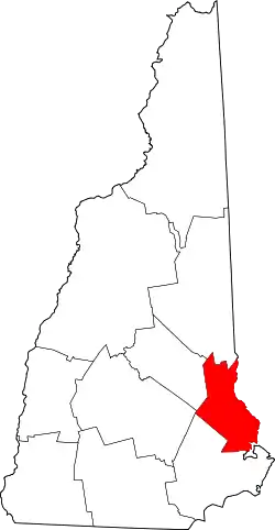 Karte von Strafford County innerhalb von New Hampshire | |
| Website: www.co.strafford.nh.us | |
Geschichte
1789 war Strafford County eins von fünf Original Countys in New Hampshire. Es wurde benannt nach William Wentworth, 2. Earl of Strafford. Das Belknap County wurde 1840 aus Strafford County ausgegliedert.
Ein Ort im County hat den Status einer National Historic Landmark, das John Sullivan House.[3] 40 Bauwerke und Stätten des Countys sind insgesamt im National Register of Historic Places eingetragen (Stand 15. Februar 2018).[4]
Einwohnerentwicklung
| Jahr | 1767 | 1773 | 1775 | 1783 | 1786 | 1790 | ||||
|---|---|---|---|---|---|---|---|---|---|---|
| Einwohner | 250 | 1357 | 1745 | 3346 | 3887 | 6985 | ||||
| Jahr | 1800 | 1810 | 1820 | 1830 | 1840 | 1850 | 1860 | 1870 | 1880 | 1890 |
| Einwohner | 11.296 | 13.560 | 16.937 | 22.376 | 23.166 | 29.384 | 31.493 | 30.243 | 35.558 | 38.442 |
| Jahr | 1900 | 1910 | 1920 | 1930 | 1940 | 1950 | 1960 | 1970 | 1980 | 1990 |
| Einwohner | 39.337 | 38.951 | 38.546 | 38.580 | 43.553 | 51.567 | 59.799 | 70.431 | 85.324 | 104.233 |
| Jahr | 2000 | 2010 | 2020 | 2030 | 2040 | 2050 | 2060 | 2070 | 2080 | 2090 |
| Einwohner | 112.233 | 123.143 | 130.889 |
Geographie
Das County hat eine Fläche von 994 Quadratkilometern; davon sind 39 Quadratkilometer (3,6 Prozent) Wasserflächen.
Nachbar-Counties
- Carroll County (New Hampshire), Norden
- York County (Maine), Osten
- Rockingham County (New Hampshire), Süden
- Merrimack County (New Hampshire), Westen
- Belknap County (New Hampshire), Nordwesten
Städte und Gemeinden
| Ortschaft | Status | Einwohner (2020)[2] | Gesamte Fläche [km²] | Landfläche [km²] | Bevölkerungsdichte [Einwohner / km²] | Gründung |
|---|---|---|---|---|---|---|
| Barrington | town | 9.326 | 125,7 | 120,9 | 77,1 | 1722 |
| Dover (County Seat) | city | 32.741 | 75,2 | 69,2 | 473,1 | 1623 |
| Durham | town | 15.490 | 64,2 | 58,0 | 267,1 | 1732 |
| Farmington | town | 6.722 | 97,2 | 96,4 | 69,7 | 1732 |
| Lee | town | 4.520 | 52,2 | 51,7 | 87,4 | 1766 |
| Madbury | town | 1.918 | 31,7 | 30,2 | 63,5 | 1755 |
| Middleton | town | 1.823 | 47,9 | 46,9 | 38,9 | 1749 |
| Milton | town | 4.482 | 89,0 | 85,8 | 52,2 | 1802 |
| New Durham | town | 2.693 | 114,3 | 107,5 | 25,1 | 1749 |
| Rochester | city | 32.492 | 118,5 | 117,6 | 276,3 | 1749 |
| Rollinsford | town | 2.597 | 19,7 | 18,9 | 137,4 | 1849 |
| Somersworth | city | 11.855 | 25,9 | 25,4 | 466,7 | 1754 |
| Strafford | town | 4.230 | 133,1 | 127,3 | 33,2 | 1820 |
Weblinks
Commons: Strafford County – Sammlung von Bildern, Videos und Audiodateien
Einzelnachweise
- Strafford County im Geographic Names Information System des United States Geological Survey. Abgerufen am 13. Februar 2015
- Decennial Census 2020. US Census Bureau, abgerufen am 3. Oktober 2021.
- Listing of National Historic Landmarks by State: New Hampshire (PDF) National Park Service; abgerufen am 15. Februar 2018.
- Suchmaske Datenbank im National Register Information System. National Park Service; abgerufen am 15. Februar 2018.
- Einwohnerzahlen vor 1790 nach lokalen Zählungen (von der Website des Bundesstaates New Hampshire (PDF) ), 1790–2010 laut US-Volkszählungsergebnissen
This article is issued from Wikipedia. The text is licensed under Creative Commons - Attribution - Sharealike. The authors of the article are listed here. Additional terms may apply for the media files, click on images to show image meta data.