Sipalay
Sipalay liegt im Westen der Insel Negros. Die Stadt gehört zur Provinz Negros Occidental in den Western Visayas auf den Philippinen. Sie hat eine Einwohnerzahl von 70.070 (Zensus 1. August 2015), die sich auf 17 Barangays verteilt.
| Sipalay | |||
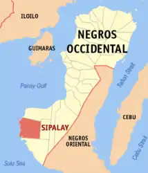
| Lage von Sipalay in der Provinz Negros Occidental | |||
|---|---|---|---|
 | |||
| Basisdaten | |||
| Region: | Western Visayas | ||
| Provinz: | Negros Occidental | ||
| Barangays: | 17 | ||
| PSGC: | 064527000 | ||
| Einkommensklasse: | 4. Einkommensklasse | ||
| Haushalte: | 11.955 Zensus 1. Mai 2000 | ||
| Einwohnerzahl: | 70.070 Zensus 1. August 2015 | ||
| Bevölkerungsdichte: | 163,8 Einwohner je km² | ||
| Fläche: | 427,7 km² | ||
| Koordinaten: | 9° 45′ N, 122° 24′ O | ||
| Postleitzahl: | 6113 | ||
| Bürgermeister: | Soledad C. Montilla | ||
| Website: | www.sipalaycity.gov.ph | ||
| Geographische Lage auf den Philippinen | |||
| |||

Geographie
Das Stadtgebiet hat eine Größe von 427,7 km² und grenzt im Westen an die Sulusee, im Norden an die Municipality of Cauayan, im Osten an die Municipality of Candoni und im Süden an die Municipality of Hinoba-an. Sipalay City ist von der Provinzhauptstadt Bacolod rund 178 Kilometer entfernt und über eine Straße in drei bis vier Stunden Fahrzeit erreichbar. Die Stadt besitzt eine Küstenlinie von 45 Kilometern.
Barangays
|
|
Quelle
- Offizielle Homepage von Sipalay City: http://www.sipalaycity.gov.ph/index.htm
This article is issued from Wikipedia. The text is licensed under Creative Commons - Attribution - Sharealike. The authors of the article are listed here. Additional terms may apply for the media files, click on images to show image meta data.