Shepherd-Inseln
Die Shepherd-Inseln sind eine zentrale Inselgruppe der südpazifischen Neuen Hebriden und Teil des Inselstaats Vanuatu. Gemeinsam mit den nördlich um die Insel Épi sowie südlich um die Insel Éfaté gelegenen Eilanden bilden die Shepherd-Inseln die vanuatuische Provinz Shefa.
| Shepherd-Inseln | ||
|---|---|---|
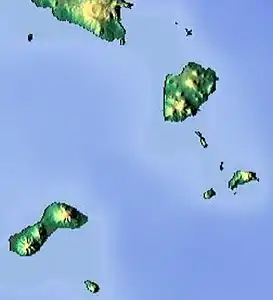 Reliefkarte der Shepherd-Inseln | ||
| Gewässer | Korallenmeer | |
| Archipel | Neue Hebriden | |
| Geographische Lage | 16° 59′ S, 168° 28′ O | |
| ||
| Anzahl der Inseln | 11 | |
| Hauptinsel | Tongoa | |
| Gesamte Landfläche | 89 km² | |
| Einwohner | 3271 (2015) | |
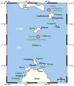 Karte der Shepherd-Inseln | ||
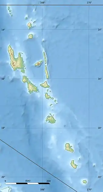
Die kleine Gruppe ist vulkanischen Ursprungs. Sie erstreckt sich in Form eines Inselbogens über etwa 50 Kilometer Luftlinie zwischen den Inseln Épi und Éfaté.
Inseln
![]() Karte mit allen Koordinaten: OSM | WikiMap
Karte mit allen Koordinaten: OSM | WikiMap
Liste der Shepherd-Inseln:
| Inselname | Aliasname | Koordinaten | Fläche | Einwohner 2015[1] | Hauptort |
|---|---|---|---|---|---|
| Tévala | 16° 49′ S, 168° 33′ O | 0,06 | - | ||
| Laika | Laïka | 16° 50′ S, 168° 34′ O | 0,35 | - | |
| Tongoa | 16° 54′ S, 168° 34′ O | 41,1 | 2.243 | Morua | |
| Ewose | Éwosé | 16° 57′ S, 168° 35′ O | 1,22 | - | |
| Valéa | Falea | 16° 59′ S, 168° 36′ O | 0,29 | - | |
| Tongariki | 17° 00′ S, 168° 38′ O | 4,7 | 274 | Tavia | |
| Buninga | Bouninga | 17° 01′ S, 168° 35′ O | 1,2 | 112 | Munpohai |
| Amora | Amora Reefs | 17° 01′ S, 168° 37′ O | 0,02 | - | |
| Émaé | Emaé | 17° 04′ S, 168° 23′ O | 36,5 | 488 | Makata |
| Makura | Makoura, Emwae | 17° 08′ S, 168° 26′ O | 2,1 | 93 | Malakof |
| Mataso | Matah | 17° 15′ S, 168° 26′ O | 1,5 | 61 | Na'asang |
Als Hauptort der Inselgruppe gilt das Dorf Morua auf der Hauptinsel Tongoa.[2] Morua war auch Verwaltungssitz der von 1985 bis 1994 bestehenden Inselregion Shepherd Islands.
Aus geologischer Sicht gehören auch die beiden unterseeischen Vulkane Kuwaé (16° 50′ S, 168° 32′ O – nördlich vor Tongoa) sowie Makura (südwestlich vor Makoura) zur Formation.