Futuna (Vanuatu)
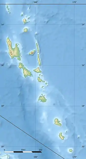
Futuna ist eine kleine Insel (mit etwa 13 km² Landfläche) im Südosten des Inselstaats Vanuatu. Die zur Provinz Tafea gehörige Insel liegt 310 km (Luftlinie) von der vanuatuischen Hauptstadt Port Vila und 101 km von der weit größeren Insel Tanna entfernt. Zwischen 1999 und 2009 nahm die Bevölkerung von 402 auf 535 zu.[1]
| Futuna | ||
|---|---|---|
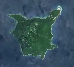 Satellitenbild von Futuna | ||
| Gewässer | Pazifischer Ozean | |
| Inselgruppe | Neue Hebriden | |
| Geographische Lage | 19° 31′ 47″ S, 170° 13′ 8″ O | |
| ||
| Fläche | 13 km² | |
| Höchste Erhebung | Tatafou 666 m | |
| Einwohner | 535 (2009) 41 Einw./km² | |
| Hauptort | Mohoun'gha | |
_1901_Nautical_Chart.jpg.webp) Seekarte (1901) | ||
Futuna ist im Osten von einem Korallenriff eingefasst.
Es gibt fünf Dörfer auf Futuna, im Uhrzeigersinn beginnend im Nordwesten:
- Mohoun'gha
- Ipao
- Matin'gi (bestehend aus Iraro, Marae, Itavai and Iakana)
- Napoua
- Iasoa
Hauptort ist Mohoun'gha im Nordwesten. Ipao im Nordosten ist unmittelbar westlich des Flughafens.
Eine aktuelle (2015) Kartenquelle weist insgesamt mehr als 20 Ortsnamen nach.[2]
Die Insel hat zehn traditionelle Regionen: Iraro, Itapapa, Itapasiesi, Matangi, Matowei, Nabao, Nariari, Rakaoroa, Serinao, und Tchinaroa.
Einzelnachweise
Weblinks
- Statistische Karte (2015)