San Quintin (Pangasinan)
San Quintin ist eine philippinische Stadtgemeinde in der Provinz Pangasinan und grenzt im Osten an die Provinz Nueva Ecija. In dem 116,5 km² großen Gebiet wohnten im Jahre 2015 32.945 Menschen, wodurch sich eine Bevölkerungsdichte von 283 Einwohnern pro km² ergibt. Die Gemeinde liegt in einer Ebene direkt neben den bis zu über 1000 Meter hohen Kordilleren. San Quintin wurde 1864 zur Stadtgemeinde und war zuvor ein Gemeindeteil von Umingan.
| Municipality of San Quintin | |||
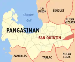
| Lage von San Quintin in der Provinz Pangasinan | |||
|---|---|---|---|
 | |||
| Basisdaten | |||
| Region: | Ilocos-Region | ||
| Provinz: | Pangasinan | ||
| Barangays: | 21 | ||
| Distrikt: | 6. Distrikt von Pangasinan | ||
| PSGC: | 015537000 | ||
| Einkommensklasse: | 4. Einkommensklasse | ||
| Haushalte: | 5667 Zensus 1. Mai 2000 | ||
| Einwohnerzahl: | 32.945 Zensus 1. August 2015 | ||
| Bevölkerungsdichte: | 282,8 Einwohner je km² | ||
| Fläche: | 116,5 km² | ||
| Koordinaten: | 15° 59′ N, 120° 49′ O | ||
| Postleitzahl: | 2444 | ||
| Vorwahl: | +63 75 | ||
| Bürgermeister: | Clark Cecil P. Tiu | ||
| Geographische Lage auf den Philippinen | |||
| |||

Baranggays
San Quintin ist in folgende Barangays aufgeteilt:
- Alac
- Baligayan
- Bantog
- Bolintaguen
- Cabangaran
- Cabalaoangan
- Calomboyan
- Carayacan
- Casantamarian
- Gonzalo
- Labuan
- Lagasit
- Lumayao
- Mabini
- Mantacdang
- Nangapugan
- Poblacion Zone I
- Poblacion Zone II
- Poblacion Zone III
- San Pedro
- Ungib
This article is issued from Wikipedia. The text is licensed under Creative Commons - Attribution - Sharealike. The authors of the article are listed here. Additional terms may apply for the media files, click on images to show image meta data.