San Andres (Quezon)
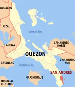
San Andres ist eine philippinische Stadtgemeinde in der Provinz Quezon. Sie hat 35.780 Einwohner (Zensus 1. August 2015). Die Gemeinde liegt auf der Bondoc-Halbinsel an der Küste des Golfes von Ragay. Zum Gemeindegebiet gehört das Alibijaban Wilderness Area, auf der gleichnamigen Insel.
| Municipality of San Andres | |||
| Lage von San Andres in der Provinz Quezon | |||
|---|---|---|---|
 | |||
| Basisdaten | |||
| Region: | CALABARZON | ||
| Provinz: | Quezon | ||
| Barangays: | 7 | ||
| Distrikt: | 3. Distrikt von Quezon | ||
| PSGC: | 045640000 | ||
| Einkommensklasse: | 4. Einkommensklasse | ||
| Haushalte: | 5549 Zensus 1. Mai 2000 | ||
| Einwohnerzahl: | 35.780 Zensus 1. August 2015 | ||
| Bevölkerungsdichte: | 181,3 Einwohner je km² | ||
| Fläche: | 197,4 km² | ||
| Koordinaten: | 13° 22′ N, 122° 39′ O | ||
| Postleitzahl: | 4314 | ||
| Geographische Lage auf den Philippinen | |||
| |||

Baranggays
San Andres ist politisch in sieben Baranggays unterteilt.
- Alibihaban
- Camflora
- Mangero
- Pansoy
- Tala
- Talisay
- Poblacion
This article is issued from Wikipedia. The text is licensed under Creative Commons - Attribution - Sharealike. The authors of the article are listed here. Additional terms may apply for the media files, click on images to show image meta data.