Palo Verde (Kalifornien)
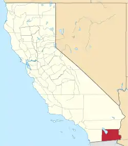
Palo Verde (früher Paloverde[1]) ist ein Dorf im Imperial County im US-Bundesstaat Kalifornien.
| Palo Verde | |||
|---|---|---|---|
Lage in Kalifornien | |||
| Basisdaten | |||
| Staat: | Vereinigte Staaten | ||
| Bundesstaat: | Kalifornien | ||
| County: | Imperial County | ||
| Koordinaten: | 33° 26′ N, 114° 44′ W | ||
| Zeitzone: | Pacific (UTC−8/−7) | ||
| Einwohner: | 152 (Stand: 2020) | ||
| Fläche: | 1,5 km² (ca. 1 mi²) davon 1,5 km² (ca. 1 mi²) Land | ||
| Höhe: | 71 m | ||
| Postleitzahl: | 92266 | ||
| Vorwahl: | +1 760 | ||
| FIPS: | 06-55422 | ||
| GNIS-ID: | 0247170 | ||
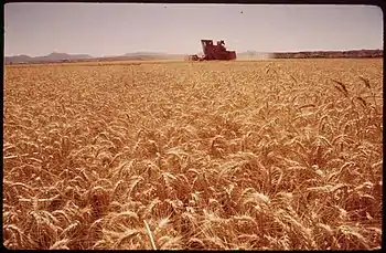
 Weizenernte am Colorado River (Mai 1972) | |||
Seine Einwohnerzahl beträgt 271 nach dem Stand der Volkszählung 2010. Palo Verde liegt an der Grenze zum Riverside County nahe der Grenze zum Bundesstaat Arizona und wird von unzähligen Kanälen durchquert. Das Dorf befindet sich an der California State Route 78.
Weblinks
- Weiterführende Informationen und Fotos auf CityData.com (englisch)
Einzelnachweise
This article is issued from Wikipedia. The text is licensed under Creative Commons - Attribution - Sharealike. The authors of the article are listed here. Additional terms may apply for the media files, click on images to show image meta data.

