Pagudpud
Pagudpud ist eine philippinische Stadtgemeinde in der Provinz Ilocos Norte und liegt westlich von Cagayan am Südchinesischen Meer. Im Jahre 2015 zählte sie 23.770 Einwohner.
| Municipality of Pagudpud | |||
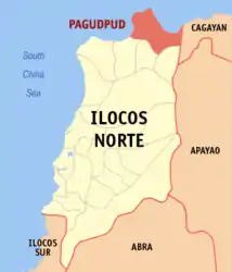
| Lage von Pagudpud in der Provinz Ilocos Norte | |||
|---|---|---|---|
 | |||
| Basisdaten | |||
| Region: | Ilocos-Region | ||
| Provinz: | Ilocos Norte | ||
| Barangays: | 16 | ||
| Distrikt: | 1. Distrikt von Ilocos Norte | ||
| PSGC: | 012815000 | ||
| Einkommensklasse: | 4. Einkommensklasse | ||
| Haushalte: | 3804 Zensus 1. Mai 2000 | ||
| Einwohnerzahl: | 23.770 Zensus 1. August 2015 | ||
| Bevölkerungsdichte: | 122 Einwohner je km² | ||
| Fläche: | 194,90 km² | ||
| Koordinaten: | 18° 33′ N, 120° 47′ O | ||
| Postleitzahl: | 2919 | ||
| Geographische Lage auf den Philippinen | |||
| |||

Pagudpud ist berühmt für seine weißen Strände mit Kokospalmen und kristallblauem Wasser. Ansonsten fällt das Land sehr steil zum Meer hin ab. Eine Stelzenbrücke führt zum Kalbario-Patapat-Nationalpark und nach Cagayan.
Pagudpud ist in folgende 16 Baranggays aufgeteilt:
|
|
Weblinks
Commons: Pagudpud – Sammlung von Bildern, Videos und Audiodateien
This article is issued from Wikipedia. The text is licensed under Creative Commons - Attribution - Sharealike. The authors of the article are listed here. Additional terms may apply for the media files, click on images to show image meta data.